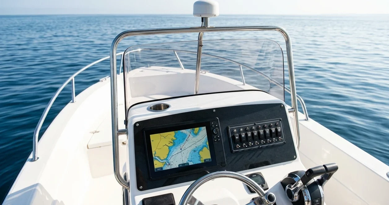
If you are choosing between Garmin and B&G for a passage-making boat, the spec sheets will not decide it. Both brands make capable chartplotters with good charts, radar support, and NMEA 2000 connectivity. The difference shows up in how the unit behaves in a seaway at night, how well it connects to the equipment already on your boat, and what you still have when it fails.
This comparison is built around those three tests. It does not list every feature of every model. For that, see our piece on the chartplotter features that matter when you are weeks from land. Radar cabling is covered separately in the guide to getting radar onto your chartplotter, which is linked in the radar section below.
Why this comparison starts with the boat you already have, not the spec sheet
A chartplotter is the display for a network of other equipment: wind and speed instruments, depth, autopilot, AIS, VHF with DSC, radar, and sometimes engine data. What is already on your boat narrows the decision before you compare a single screen.
NMEA 2000 carries standard data between brands. Position, depth, speed, wind, heading, and AIS targets generally flow from one manufacturer’s sensors to another’s display. Proprietary functions are different. Autopilot control, radar, calibration, and some performance features generally work fully only inside one brand’s ecosystem, and this is where mixing brands costs you.
Before you look at any plotter, write down:
- Which wind, speed, and depth instruments you have, and which brand they are.
- Which autopilot you have, and whether you want the plotter to steer it.
- Whether you have radar and, if so, its brand and model.
- Whether your AIS and VHF connect over NMEA 2000, NMEA 0183, or both.
- How many displays you want: one at the helm, one at the chart table, or one in the cockpit and one below.
If you already own a B&G instrument system or a Garmin autopilot, the matching plotter is the low-friction choice, and you would need a strong reason to cross over. If the boat is nearly bare, you are choosing an ecosystem, and the three tests below matter more.
Interface in a seaway: touchscreen, keys and knobs, and what you can still operate at 3am
Interface quality offshore has little to do with how a demo unit feels on a shop counter. It depends on a few conditions the showroom lacks: a boat that is moving, a hand that is wet or gloved, a screen turned down to its lowest brightness, and a tired brain.
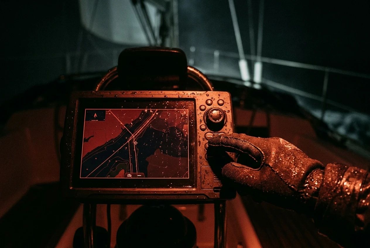
The first point is physical control. Both brands sell models with touch only, with touch plus keys, and with touch plus a rotary knob. This varies by model, not by brand, so check the exact model you are considering. Capacitive touchscreens respond poorly to wet gloves and can register spray droplets as touches. When the boat is pitching, aiming a fingertip at a small icon is harder than pressing a key you can locate by feel. On a passage boat, a unit with physical keys or a knob at the helm is worth more than any feature the touch interface adds.
Run this checklist on any plotter you are considering, ideally on a boat or a display demo with the lights down:
- Set the brightness to its lowest level and the display to night mode. Can you still read depth, speed, and heading? Is any text in colors that wash out when dimmed?
- Put on the gloves you actually sail in, and wet them. Zoom the chart, change pages, and acknowledge an alarm.
- Press the man overboard function. Does it need one press or a confirmation? Where is the button, and can you find it without looking?
- Silence an alarm and then find out what caused it. Alarms that are hard to silence get ignored or switched off, which defeats their purpose.
- Change the range on the radar page and adjust gain, using only the controls you can reach from the helm seat.
- Rotate through your pages. Can you do it in two or three presses without going through a menu?
Also look at how the menus are structured. A plotter with many layers of settings is fine at anchor, but at 3am on watch you want the common tasks (range, brightness, waypoint, MOB, alarm silence) within one or two actions. Time yourself on each. If a task takes eight taps in the shop, it will take longer in a seaway.
Last, think about where it is mounted. A plotter in the companionway is viewed differently from one in the cockpit exposed to spray. If you plan to fit a second display, check that it can be controlled independently and that the controls match the first. Different interfaces at the helm and the chart table add to the cognitive load.
Sailing-specific displays: how each brand handles wind, laylines, tides and performance data
B&G’s heritage is in racing and performance sailing, and its plotters are built around sailing functions. Garmin has added sailing features to its marine range as well. Both offer laylines and a wind-referenced steering display. What differs is how deep the performance side goes and how it ties into the boat’s instruments.
For an offshore sailor, separate the features you will use every watch from the ones that matter on race day. The ones that matter on passage are:
- True and apparent wind, with angle and speed, on a page you can read from the helm.
- Course over ground and speed over ground next to heading, so you can read leeway and current at a glance.
- Cross-track error, distance, and time to the next waypoint.
- Tide and current information near landfalls, including set and drift where available.
- Wind and weather overlays, and whether these are built in, need an app, or need a subscription.
Laylines are useful when approaching a harbor or beating along a coast, but they depend on accurate wind data and a sensible polar or tacking angle. If you do not calibrate the instruments and enter realistic angles, laylines give a false sense of precision. Check how each system handles calibration, and whether it is done on the plotter or on a separate instrument processor.
If you want polar-based performance targets, find out where the polar data is loaded and stored. A system tied to a dedicated instrument processor (as B&G’s performance instruments are) behaves differently from one that relies on the plotter alone. Ask whether the polar can be adjusted for your boat, and whether you will use it. Many cruising sailors never load one, so this difference does not matter to them.
Radar integration: what pairs natively, what needs workarounds, and what you give up by mixing brands
Radar is where brand choice has the largest practical effect. Radar scanners communicate with displays over a manufacturer-specific network protocol, so a plotter needs to understand the protocol of the scanner it is connected to. Within one brand, you connect the scanner to the network, the plotter detects it, and you get radar on any displays on that network. Across brands, this generally does not work.
When you stay in one ecosystem, you get:
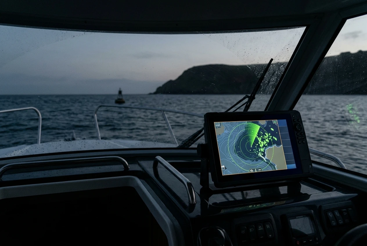
- Radar overlay on the chart, so you can see whether a target is a buoy, a headland, or something that is not on the chart.
- Control of the scanner from every networked display.
- Guard zone alarms and target tracking displayed alongside chart and AIS data.
- Software updates and settings managed through one interface.
If you mix brands, you give up some or all of these, depending on the combination. Common workarounds are running the radar on its own dedicated display, or checking each manufacturer’s compatibility list before you buy to see exactly which combinations are supported. Do not assume that a radar will work with a plotter because both are sold as marine electronics. Check the model-by-model compatibility information from the manufacturer, and confirm the answer in writing from a dealer if you are spending real money.
The practical sequence is to decide on the radar and plotter together. If you already own a radar and are replacing the plotter, the radar’s brand points to the plotter’s brand. If you own a plotter and are adding a radar, the same applies in reverse. The cabling, network, and settings that decide whether overlay works are covered in our guide to getting your radar onto your chartplotter.
Radar draws a meaningful amount of power when transmitting, and on a boat that spends days offshore, that affects your energy budget. If you plan to run radar on night watches, include it in the numbers from our guide to building a boat power budget before you choose a scanner size.
Reliability over years offshore: software updates, network faults, warranty terms, and service access to check before buying
Reliability claims in marketing material do not tell you much. What you can check before buying is the support structure around the equipment.
Software updates
Find out how updates are delivered. Some units update from a memory card, some through a phone app or Wi-Fi, and some need a computer. When you are in a remote anchorage or mid-ocean, you will not have a good internet connection, so check that the update files can be downloaded in advance and installed offline.
Read the release notes before you update, and do not update the week before a passage. Software changes can alter menus, settings, and network behavior. Before updating, save your waypoints and routes to a card, and keep the previous software version if the manufacturer allows it.
Network faults
Most faults that look like a dead plotter are network or power faults. Two weak points deserve inspection at installation:
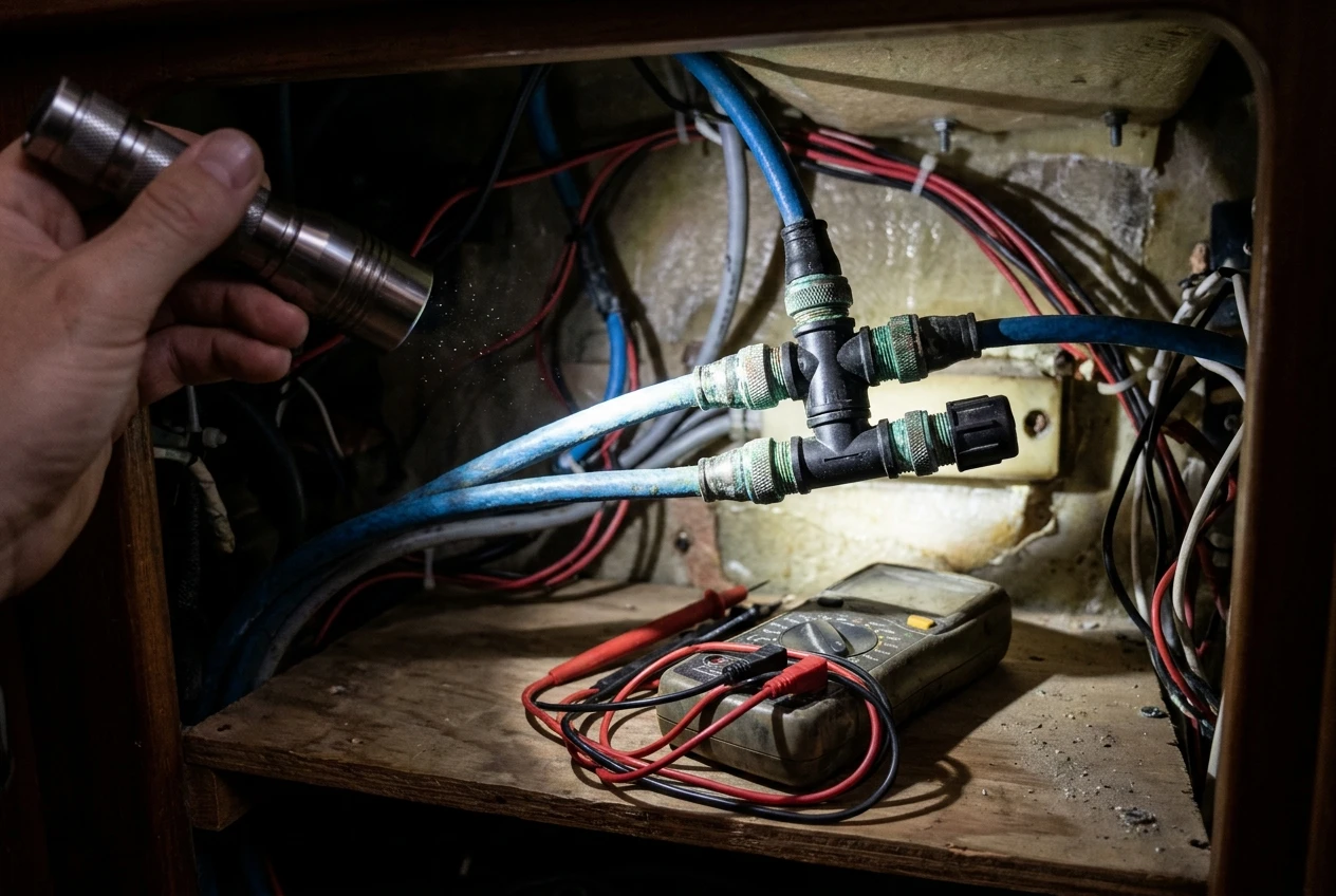
- The NMEA 2000 backbone. A single break or a failed terminator can take down all instruments at once. Check that the backbone is correctly terminated, powered at a sensible point, and that connectors are protected from moisture.
- The Ethernet connections for radar, sonar, and networked displays. Connectors corrode, and a single bad cable can drop the radar from every screen.
Ask the installer, or ask yourself, how you would isolate a fault. A network that can be split into sections and tested individually is far easier to troubleshoot at sea than one that is all joined together.
Warranty and service access
Warranty terms differ by country, by model, and by how the unit was purchased, so read the actual document. Ask these questions:
- How long is the warranty, and does it cover a boat used offshore and for long periods?
- Does it require registration or professional installation?
- Who handles repairs in the countries where you plan to sail, and how long does a swap or repair take?
- Are spare parts and replacement displays available through local dealers?
A manufacturer with service agents along your intended route is worth more than one with a longer headline warranty and no one nearby. Contact the dealers in two or three of the ports you expect to use and ask what they stock and service.
What happens when the plotter dies: failure modes, redundancy and the backup you still need
Every plotter eventually fails, and the useful question is how. The common failure modes are:
- Power loss or a power surge. A voltage drop during engine start can reset or damage a unit. Check that the plotter is on a stable supply and that its supply is independent of the engine start circuit. Our piece on why safety electronics die with the house bank covers the wiring side.
- Screen failure or water ingress. Seals age, and a cockpit unit is exposed to constant spray and sun.
- Software lockups or a corrupted card. A restart usually fixes a lockup. A corrupted card can cause you to lose your charts.
- GPS antenna or position source loss. The plotter is working, but it has no position.
- Network faults. The plotter is working, but it has lost the radar, instruments, or autopilot.
Which brand handles failure better depends on what you build around it. A second display on the same network gives you another view if one screen fails, provided the network itself is intact. Two displays on one power circuit share a single point of failure, so wire them separately where you can.
Beyond the plotter, carry a navigation method that does not depend on it. At minimum:
- A handheld GPS with its own batteries, loaded with your route as waypoints. See our guide to handheld GPS devices for emergency use at sea.
- Paper charts of your departure, landfalls and the areas where you will be closest to hazards, plus a plotting tool and a handbearing compass.
- A tablet or phone with offline charts, charged and kept separate from the main electrical system.
For the specific ways satellite positioning can fail and the backup that covers each, read Six Ways GPS Lets Sailors Down. Practice using the backups before you leave, not on the night you need them.
Which sailor should pick which, and the questions to settle before you order
Neither brand is the better choice in general. The better choice is the one that fits your boat and how you sail.
Garmin is likely to suit you if:
- Your autopilot, instruments or radar are already Garmin.
- You want a plotter that is mainly a navigation and chart display, with sailing features as a bonus.
- You value the available range of models and the option to build a mixed-sensor network around one brand.
B&G is likely to suit you if:
- You already own B&G instruments, or want a full performance instrument system with polar-based targets.
- Your sailing involves racing or performance trimming as well as passage-making.
- You want sailing displays that are central to the unit’s design.
Either could suit you if your boat is bare and you plan to buy the whole system; in that case, the interface test and the service-access check should decide it.
Settle these questions before you order:
- What brand are my radar, autopilot, and instruments, and what do I want to keep?
- Does the exact model I am considering have physical keys or a knob, or is it touch only?
- Can I operate it in wet gloves with the screen dimmed?
- Will I use performance features such as polars, or only wind, position, and navigation data?
- How are software updates delivered, and can I do them offline?
- Where is service available along my route, and what does the warranty cover offshore?
- What is my independent backup, and have I tested it?
- How will I wire the plotter’s power so a single fault does not take down navigation?
Once the plotter is fitted, the habits you use on watch matter as much as the hardware. Our guide to running a night watch with radar, AIS and a chartplotter covers how to use all three without relying on any single one.
This article was created with AI assistance and reviewed by a human editor.
Disclosure: This post contains Amazon affiliate links. If you buy through them, we may earn a small commission at no extra cost to you.
About The Author


