Can You really use Google Maps for Marine Navigation?
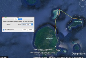
Let’s take a look at how to find a GPS position and create your next Pacific Islands passage plan with the help of so familiar for everyone Google Earth geo-browser.
Although generally, I am a so-called „old school” marine navigator modern technologies are very welcomed, and often it makes sailing more comfortable.
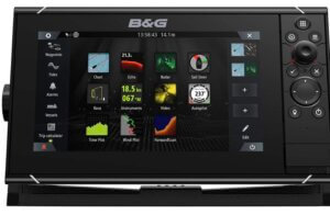
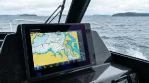
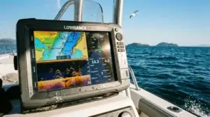
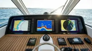
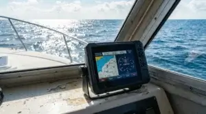
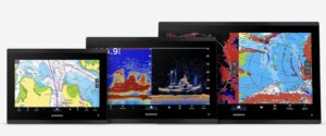
There are so much different brands and types of Marine electronics on the industry market. Sometimes is rather hard to choose from Raymarine, Garmin, Furuno or Lowrance offers and none is perfect. You need to have personal experience and some art to find the best one for the moment.
It is not a secret that one of the most important indicators is a price but it doesn’t mean that always the most expensive GPS for boats is the best.
No doubt that your great sailboat should be equipped with appropriate safety equipment, spare sails, engine parts, and certainly with proper marine navigation tools and devices. Wise skippers always collect paper charts for expected routes and adjacent areas. Even having a good and up-to-date GPS Chartplotter better place Admiralty Charts or US NOAA nautical chart collection in a drawer.
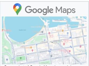
I will not talk about navigation software and different types of GPS navigation devices because I have already written quite a lot about it. This time about Google Maps for marine navigation mode.
Everyone, well almost all of us, know Google Earth and Google Maps. This Internet feature gives us a great opportunity virtually travel around the world.
As a professional navigator, I would never consider the use of Google Maps as a navigational tool. For safe navigation should constantly be used updated nautical paper charts or electronic equivalent exist. It is like street maps in turn by turn GPS for cars devices. But what about mapping for off-roads or OHV stands for „off-highway vehicle “?
Numerous communities and online sharing options could be found for GPS for ATV trails and other off-roaders. Sometimes Google Earth Maps are the best place to start.
When it comes to sailing, I should accept that idea of using satellite imagery is quite impressive and in some situations even helpful.
Oceans area is huge and to be honest, not every area is covered with a decent hydrographic survey to make nautical charts. Every country is responsible for executing such surveys in its territorial waters. Not all countries have enough budget to cover all waters with the very detailed hydrographic survey, so only commercial shipping routes are maintained for safe navigation.
For recreational navigation, you need to be highly careful, especially when sailing in tropical coastal waters where coral reefs are a very common obstacle. It is no secret that reefs are growing fast and even a couple of year old soundings with safe passage could lead to insufficient under keel clearance. It is a reason for many groundings in South Pacific or Indian Ocean waters around coral islands and atolls.
How to lower risk of such an accident and enjoy beautiful Polynesian sunset gliding with the fr
esh evening breeze?
Definitely, there are nautical charts almost any sailing are and if you can not find one then better keep clear of the uncharted area. As I said before some maps are updated a long time ago due to a lack of hydrographic surveys and depth can significantly differ from numbers on nautical charts.
I am not sure, but somehow Google Earth picture could help.
Not solely Google Earth image but in combination with other navigation software as
Russian SAS.Planet
Unfortunately, I couldn’t find the English version (I speak Russian fluently) but even using Google Translator; you be able to understand the main idea. It looks really cool free soft for PC; the MAC version has not been found.
https://www.youtube.com/watch?v=f65JbGY_Aeg
Together with OpenCPN.
It is free, open-source software for marine navigation. It is available for Mac OSX, Microsoft Windows, GNU/Linux, BSDs, and Solaris. The latest stable version of OpenCPN at the time of writing is 4.6.1 released March 31, 2017.
I would not like to overwrite tips and tricks on how to use Google Earth navigation posted by Pacific cruiser Rory Garland, you can read it here. Just my two cents. To use Google Maps for Marine Navigation the Internet connection is essential, luckily cell phone coverage today is good even in remote Pacific island areas and internet connection accordingly. Even if you lose the internet, you can prepare your sailing route and voyage plan beforehand.
From first sight, this technique could look rather complicated but if you are a savvy computer user and knowledgeable in nautical charts then after little training and exercises you could reach decent results.
Another similar technique I found is by using EarthNC.
You can read for details on Techwalla site, but I like more the first method used by Pacific cruiser Rory Garland.
See Seek Navigation tool is Google Maps distance calculator and could be helpful as a quick route planner to calculate fuel consumption and other estimates of an expected voyage.
Most likely you can find another way How to use Google Maps for marine navigation but I’d like to say my conclusion regarding the topic.
For safe navigation must be used updated marine navigation charts both paper and electronic. For commercial shipping, strict International Regulations are implemented and supervised by IMO (International Maritime Organization) regarding nautical charts and no way to step aside.
When it comes to recreational boating then only a skipper and (or) boat owner is responsible for safety. Appropriate and updated navigation maps for the sailing region is one of the most important things to avoid unpleasant surprises during a voyage.
The path from Los Angeles to Hawaii
The use of Google Maps for Marine Navigation could be considered as an additional informative tool, but not as the main navigation tool for safe sailing.
Fair Winds and Following Seas fellow Mariners.



I never would have thought that GPS could be used for ocean navigation but it sounds like a cool concept! I think I would prefer to go out on the ocean with a professional rather than trying to sail the ocean blue on my own or with others who don’t know what they are doing either!
Hi, Trisha and thanks for stopping by.
Actually, GPS stands for Global Positioning System is just one of six presently active (some of them like European Galileo in finishing stage) satellite navigation systems. The US GPS is just most popular and worldwide open since not so far years ago.
Maritime navigation is almost impossible without GPS. Traditional marine navigation skills like using of sextant and star globe, even paper nautical charts, young navigators forget soon after Marine College graduation. You are absolutely right when talking about professional skipper on the board of any ship. No matter whether it is a sailboat or Panamax size crude oil carrier.
As an example of consequences see what happened with sail catamaran Zingarella just last week. Skipper ignored clear marked warning sign about air clearance under the high voltage power line, touched the cable, and a fire broke out. Twelve people including six children were seriously injured.
I didn’t think that GPS is also for sea travel.
By no means would I go on the water without a craftsman with me, not even on a lake. I have this experience.
I’ve heard a lot about GPS from parents tracking their children.
Only from movies do I know about navigation on the seas and oceans, and that the North Star is used.
I hated naval catastrophes, I read books like Joule Verne and so on, but I never traveled by sea and ocean.
Respectfully
Vasile,
How could I use Google Earth Pro to assist in navigating from Los Angeles to Hawaii?
Thank you, Bert
Hi, You can use Google Earth Pro to calculate the passage distance in general (use Ruler, Path). Never use it for coastal navigation but all in all, no probs to locating your position even from iPhone GPS data.