The introduction of multiband GNSS modules to bluewater cruising has really switched up what I expect from navigation electronics.
With accuracy and reliability now getting close to professional survey levels, GNSS modules are becoming standard equipment for those sailing beyond coastal waters. In this article, I’m sharing the main lessons I’ve learned using multiband GNSS for long-distance ocean passages, focusing on what’s worked well, where I hit snags, and how I recommend approaching the tech for safe and confident navigation offshore.
Why Modern Bluewater Cruisers Are Switching to Multiband GNSS Modules
Sailing offshore means dealing with periods of reduced visibility, unreliable charts, or long stretches far from any landmarks. Older GPS-only chart plotters would sometimes drift a hundred meters off, especially near islands, over reef edges, or aiming for tight anchorages at dawn. That’s what pushed me to start researching the latest GNSS tech for cruising, and I quickly found that multiband GNSS modules live up to a lot of the hype.
Multiband GNSS receivers use at least two radio frequency bands and can also pick up multiple satellite constellations like GPS, Galileo, GLONASS, and BeiDou. This system gives most users horizontal positioning accuracy of sub-meter on the open ocean, especially when compared to legacy singleband GPS that can be 5-10 meters off even on a clear day. Having this improved accuracy has made a real difference for safety, anchoring, and coastal approach work of any kind.
Key Advantages of Multiband GNSS Modules for Ocean Sailing
Switching to multiband GNSS systems on my boat has given me clear benefits both for everyday use and tricky conditions. Here’s how I’ve found multiband GNSS modules push navigation safety and efficiency forward:
- Boosted Positioning Accuracy: Dualfrequency measurements help solve errors caused by the ionosphere. In practice, my chart plotter matches up with visual bearings almost perfectly in decent conditions.
- Faster Satellite Lock and Reacquisition: The system finds multiple satellite signals faster than older GPS devices. After a signal dropout, chart data returns right away as soon as the interference clears, super useful in rain or near lightning.
- Reduces Chart Plotter Wobble: When the boat swings at anchor or drifts in heavy weather, the position track stays much steadier. I spot less random jitter on the screen, which makes laying anchor alarms a lot more dependable.
- Improved Performance Near Land and Obstacles: Coastal approaches and tight passes become less risky since the high precision cuts back on second-guessing when plotting waypoints close to hazards.
- Better Integration with Modern Autopilots: Multiband GNSS feeds higher-quality data to my autopilot system. Coursekeeping improves, and there’s less need for manual intervention on long auto steered journeys.
Using this gear really feels like a whole category of navigational worry has disappeared. I spend less time looking for small errors and feel more confident entering unfamiliar anchorages after overnight passages.
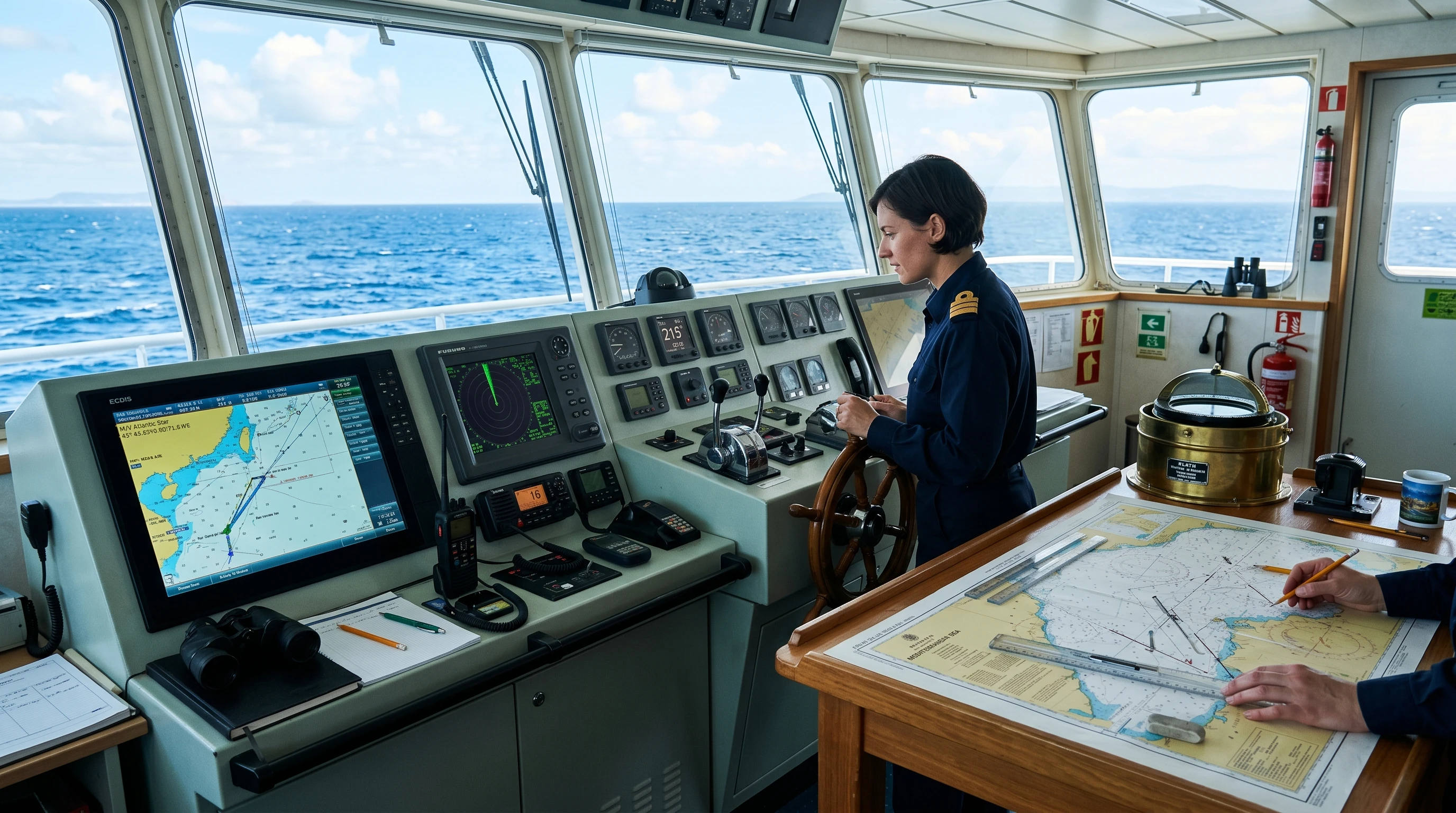
How Multiband GNSS Improves Real-World Navigation on Bluewater Adventures
On a recent Pacific crossing, my route took me way off traditional shipping lanes with little chart detail and no backup aids to navigation. Having a multiband GNSS system meant I could set drifts with precise hourly fixes, even in rough conditions or squalls. This helped me stick to my ETAs and logbook entries, especially when hand-steering or searching for the best wind angle.
Another advantage came when anchoring at coral atolls. In the past, I’d dropped the hook based mostly on guesswork or sketchy fixes from older GPS gear, then grabbed the mask to check that I wasn’t on coral. With the new multiband GNSS, I could plot my drift right to the edge of the safe zone, drop the anchor accurately, and see the exact circle the boat was swinging, no surprises, less stress, and no damage to the reef or need to re-anchor in the dark.
I share my real-world findings with other cruisers, and most agree that the accuracy levels are on par with the dedicated survey gear from just a decade ago. Knowing that my system truly matches the charts makes nighttime approaches and daily navigation a lot less stressful.
Comparing Multiband GNSS Modules: What Features Matter Most Offshore?
Shopping for bluewater GNSS modules is different from picking gear for inshore use. Here’s what I look for when comparing the best multiband GNSS options for ocean navigation:
- Number of Bands and Constellations: Dualband at a minimum is needed for the full benefit. Multiconstellation support adds redundancy if one system goes down.
- Update Frequency: A higher refresh rate (10Hz or more) is great for feeding data to the autopilot and producing smooth, high-resolution chart plots.
- Output Options: NMEA 2000 output is pretty much expected, but having legacy NMEA 0183 and USB/serial compatibility lets you connect to older charting software or laptops.
- Waterproofing and Shock Resistance: Bluewater is tough on gear. Pick modules rated for marine use with sealed cases for more dependability offshore.
- Low Power Draw: On small boats using solar and batteries, every watt counts. Power-efficient GNSS modules help extend your off-grid endurance.
- Price-to-Performance: Top-shelf survey units give next-level cool performance, but the midrange modules often come close for less cash.
For ocean crossings, I recommend balancing budget with backup. Get two independent GNSS units, maybe an integrated MFD system and a backup USB GNSS receiver on a laptop; this covers you if one fails or your main battery bank bites the dust.
Best Practices Using GNSS Modules for Offshore Cruising Success
Installing multiband GNSS gear has its quirks on a liveaboard yacht. Here are some best practices I picked up through real-life use and tips shared by seasoned sailors:
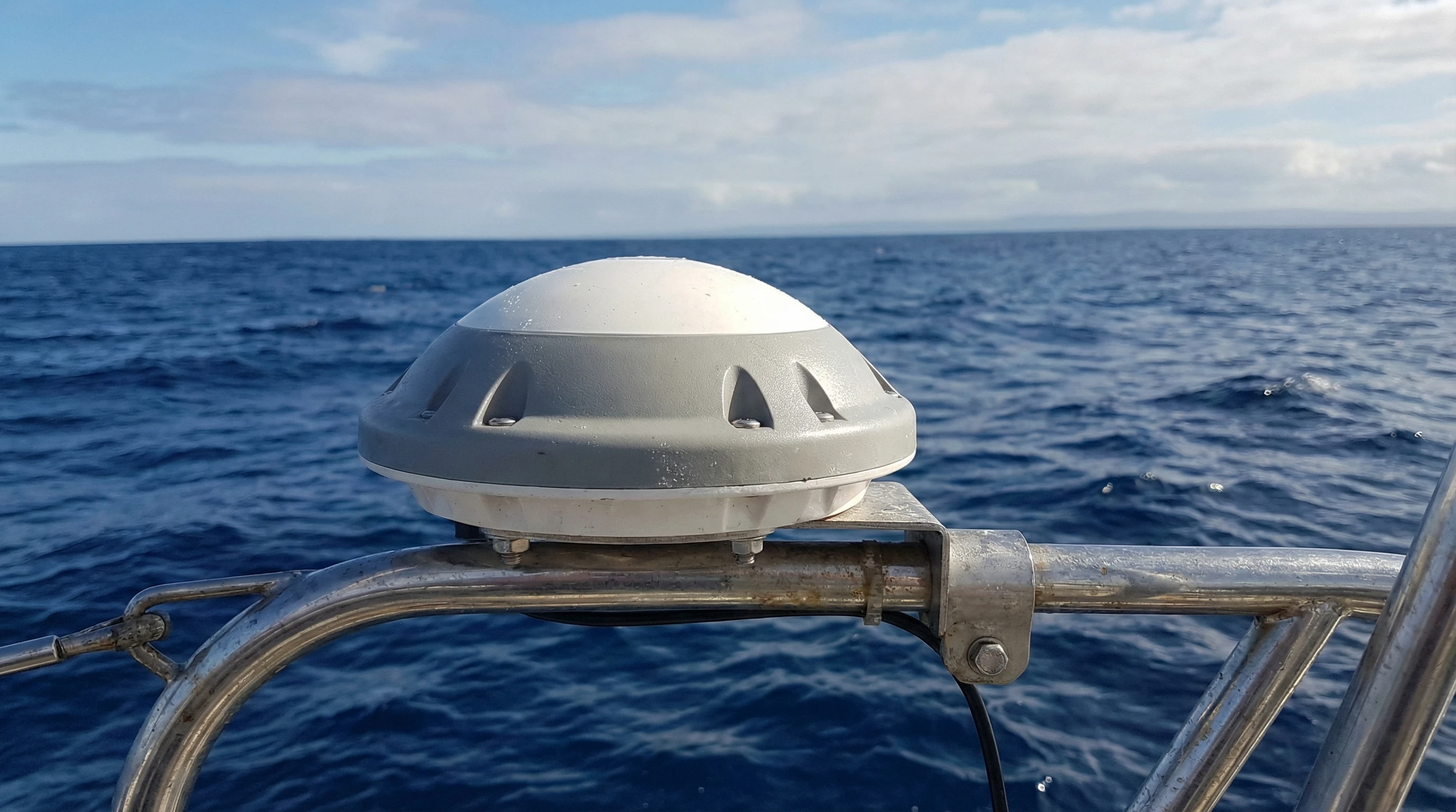
- Antenna Placement: High, clear, and far from VHF and radar is best. On my boat, I mount the GNSS antenna on the stern rail for a good line of sight and short cable runs.
- Shielding and Grounding: GNSS signals are faint and easy to disrupt. Shielded cables and solid grounding cut down interference from SSB radios, radars, and solar charge controllers.
- Redundancy: Backup systems matter. I carry a compact USB multiband GNSS dongle in my grab bag, since even the best main system can go down unexpectedly out at sea.
- Software Updates: Manufacturers regularly put out firmware upgrades for better satellite tracking or error correction. Schedule updates in port to fix glitches or get a boost in performance.
- Monitoring GNSS Status: Don’t just check the chart, keep an eye on satellite status screens. If accuracy or satellite count drops, double-check things before making route changes or approaching hazards.
- Physical Protection: Keep the receiver dry and safe from shocks. Water ingress from big waves is a common killer, so fit weather shrouds or pick modules rated to IP67 or higher.
Challenges and How to Avoid Common Pitfalls with Multiband GNSS
Even top-shelf GNSS systems aren’t foolproof. Here are some of the biggest issues I or my fellow cruisers have faced, plus suggestions for sidestepping problems at sea:
- Electrical Interference: LEDs, poorly shielded solar charge controllers, and HF radios can all produce electronic noise that messes up positioning. Using ferrite clamps and keeping cables apart helps fix this.
- Physical Damage: Marinerated equipment can still take a beating when the weather gets wild or gear shifts unexpectedly. Secure everything properly and use strain reliefs on connections to avoid surprises.
- Chart Discrepancies: Not every chart set uses the same datum. Always double check your module’s settings and verify visually or cross-reference paper charts before trusting a digital fix.
- Software Bugs: Firmware updates sometimes introduce problems or lose legacy features. Back up your settings, and read update notes before installing right before a passage.
- Power Issues: Unstable voltage or low batteries can knock out your GNSS or cause restart loops. Managing power is important, especially with solar setups that get tested by cloudy conditions.
Electrical Interference
On one crossing, unexplained signal drops drove me crazy until I chased the source down, it turned out to be a string of cheap LED strip lights. Switching them for marine-certified lights fixed the issue, reinforcing that good gear pays for itself in the long run.
Physical Damage
Wave action can be brutal on deck electronics. I use solid mounting brackets for antennas and check all bolts before long passages. Exposed wiring deserves spiral wraps or conduit to prevent chafing.
The Latest GNSS Tech for Cruising and What’s Coming Next
Manufacturers push out upgrades and updates constantly. I keep track of new features on forums and release notes. Here’s what’s noteworthy for anyone fitting their boat this year:
- RTK Corrections: Real-time kinematic (RTK) receivers are trickling down to affordable levels. With satellite data plans, some cruisers now get corrections offshore for centimeter-level accuracy a big leap from a few years ago.
- Integration with AIS and Weather Sensors: Plugandplay networking lets GNSS data sync up with AIS and real-time weather sensors, providing better situational awareness at sea.
- Cloud-Linked Logs and Track Sharing: Some MFDs and nav apps now let you upload tracks to the cloud for backup or to share adventures with friends and family, even from the middle of the ocean.
When sizing up the best GPS systems for cruisers, check what features brands offer and always verify their support and update track record. It’s worth joining online groups for your chosen brand to catch tips or updates that could make a difference on your adventure.
Real-World Stories: How GNSS Modules Changed My Ocean Crossings
On a solo passage from the Marquesas to Hawaii, I used a dualband GNSS receiver paired with OpenCPN on a rugged tablet. For almost three weeks, the system never dropped below twelve satellites, even in strong morning rain that blanketed the boat in static. The steadiness of my tracks made plotting fuel use and tracking currents far simpler than with my old gear.
I’ve also seen multiband GNSS come through when anchoring in uncharted spots. Setting the hook right after sunset is less nervewracking when your digital position stays steady to within a couple meters. Other cruisers with similar setups have echoed this, pointing out that night entries, which used to be wildly risky are now doable and much safer with high-precision fix data.
Overall, adding a multiband GNSS module gave me the confidence to stretch my cruising plans. The gear has easily paid for itself, especially in peace of mind and reduced risk during challenging conditions.
FAQs: Answering Common Questions About Multiband GNSS in Bluewater Cruising
Question: Are all multiband GNSS modules compatible with my existing chart plotter?
Answer: Many new multiband GNSS modules support NMEA 2000, which should work with most modern marine electronics. For older setups, NMEA 0183 or USB may be needed. Always check compatibility before buying to avoid extra work.
Question: How do I pick the best multiband GNSS for ocean navigation?
Answer: The best pick depends on your boat and budget. Look for dualfrequency support, solid waterproofing, fast update rates, and smooth integration with your system. Ask other bluewater sailors and look up online reviews for firsthand insights.
Question: What backup should I have if my primary GNSS fails offshore?
Answer: Pack a USB GNSS receiver (with its own battery or solar support) and a set of paper charts for backup. Learning basic celestial navigation is another smart safety net for long hauls.
Question: Can atmospheric conditions disrupt multiband GNSS reliability?
Answer: Multiband GNSS does a much better job handling ionospheric interference than singleband, but big magnetic storms or direct jamming can still cause trouble. Keep backups and monitor accuracy, just to stay safe at sea.
Final Thoughts: The Real Impact of Multiband GNSS on Bluewater Cruising
Multiband GNSS modules are quickly becoming go-to gear for bluewater sailors who want safer, reliable navigation. The leap in accuracy, redundancy, and integration with other tech has let me along with plenty of other cruisers, plan bolder trips and feel better prepared when the weather or visibility goes sour. Making the most of multiband GNSS really adds a layer of safety and confidence that’s hard to overstate for anyone venturing offshore on a regular basis.
If you’re prepping for an ocean crossing or thinking about upgrading your nav gear, I strongly suggest digging into multiband GNSS modules for bluewater sailing and comparing your options closely. Careful setup, an attention to detail, and a solid backup game plan will let you get the most out of these advances, smoothing the way for safer and more enjoyable adventures across the world’s oceans.
About The Author