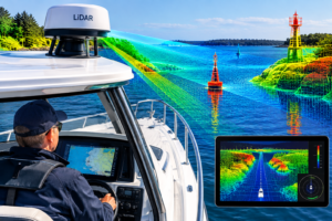
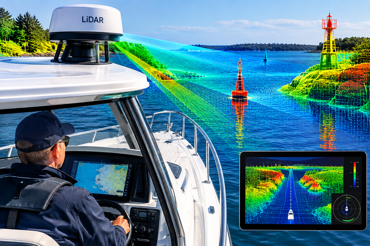
LIDAR (Light Detection and Ranging) works by firing laser pulses and timing their return to build a precise 3D “point cloud” of everything around the sensor. On boats, it’s a fairly new addition to the electronics stack, and it fills a specific gap rather than replacing anything you already use.
Where it fits alongside radar, GPS and cameras
Radar sees far (miles), works in fog and rain, and is the backbone of collision avoidance, but its close-range resolution is coarse. GPS tells you where you are but nothing about what’s around you. Cameras give rich visual detail but can’t measure distance well on their own. LIDAR’s strength is centimeter-level distance and shape measurement at short- to medium-range, which is exactly what you need for docking, tight marinas, locks, and spotting small objects like buoys, kayaks, or debris that radar can miss. Its main weaknesses are range (hundreds of meters, not miles), degraded performance in heavy fog, rain, and spray, and difficulty with the water surface itself, which reflects the laser poorly or erratically. That’s why it’s almost always fused with cameras and radar rather than used alone.
What’s actually on the market
The leading consumer example is the Raymarine x Avikus collaboration. NeuBoat Dock (and the next step, NeuBoat Navigation) is available for newly built powerboats and catamarans, providing a bird’s-eye view of the boat using an integrated system of multiple cameras and LiDAR. Avikus has also released a newer unit: its Navi with Control bundles a 142-degree field-of-view camera and a LiDAR sensor with a 1,640-foot detection range into an IPX6-rated housing (roughly 500 meters). Avikus sources its sensors from Seyond, whose Falcon LiDAR was selected to provide long-range detection, navigation assist and autonomous functionality across several new models. Most of these systems are aimed at new-build boats from partner manufacturers rather than retrofit, and they’re priced at the premium end. SeaHelp News +2
Research and autonomous vessels
This is where most of the development is happening. Research projects such as “Roboat II” have developed autonomous watercraft that use LiDAR for navigation in urban waterways, and LiDAR has also been used on boats for hydrographic surveying of coastlines and water bodies. University teams in the RoboBoat competition rely on it heavily; for example, Cornell’s 2026 entry uses computer vision and LIDAR together, with a LiDAR-based docking system that follows a multi-stage waypoint navigation strategy. Recent academic work also points out the core challenge: marine environments are a uniquely difficult sensing problem because the area is vast and largely featureless, and sea states change continuously, so algorithms built for self-driving cars don’t transfer directly.
Practical takeaway
For a typical recreational or commercial boat today, LIDAR is a docking and close-quarters aid, not a navigation system in the GPS/radar sense. For ships, it’s mainly appearing in autonomy trials, berthing assistance, and surveying. Expect it to become more common as part of “assisted docking” and autonomy packages over the next few years, but radar, AIS, and ECDIS/chartplotters will remain the core of navigation, and seafarers still need the traditional skills.
Is this for an article you’re writing, or are you looking at it for a specific boat? I can tailor the depth and angle either way.
This article was created with AI assistance and reviewed by a human editor.
About The Author