Marine GPS chartplotters have become an essential tool for anyone serious about boating. Gone are the days when mariners relied solely on paper maps and compasses. Today, these devices blend traditional navigation with modern technology to make sea travel not just safer but more intuitive.
Understanding the evolution of marine navigation systems is crucial for appreciating the value that GPS chartplotters bring to the table. Starting from basic GPS units and moving up to sophisticated chartplotters, technology has drastically improved the accuracy and ease of marine navigation.
GPS chartplotters provide a level of precision and detail that is unmatched by older navigation methods. They integrate real-time data, such as speed and depth readings, with elaborate maps that help navigate tricky waters. This technology ensures that navigators can avoid hazards and reach their destinations more reliably.
Having such advanced tools at your helm means that you’re not merely relying on sight and traditional skills. You’re equipped with cutting-edge technology that guides you through the water. The integration of GPS technology in these chartplotters has transformed the way mariners view navigation, making marine travel more efficient and less risky.
Whether you’re a seasoned sailor or a beginner, understanding the basic functionality and benefits of marine GPS chartplotters is the first step toward improving your boating experience.
The Anatomy of a Marine GPS Chartplotter
A marine GPS chartplotter packs a lot of technology into a compact device, and understanding its components can help you make the most of its features. At the heart of a GPS chartplotter is the GPS receiver, tasked with pinpointing your exact location at sea. This receiver connects to a number of satellites to provide accurate, real-time location updates.
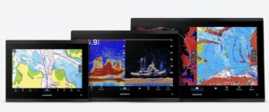
The display screen is another crucial element, designed to project clear and detailed charts, which are essentially digital maps of the sea. These screens can vary in size and resolution, but clarity and visibility are vital to ensure you can easily read the information while on a moving vessel.
A key component that sets chartplotters apart from regular marine GPS devices is their ability to incorporate electronic navigational aids, like waypoint plotting and route tracking. This feature enhances your navigation strategy by allowing you to plan and visualize your journey before you even set sail.
The interface and controls are designed for practical use even in challenging conditions. Whether your chartplotter uses buttons or a touchscreen, it’s essential that it’s intuitive enough to operate under rough weather situations.
Different manufacturers might include additional features like sonar integration or radar overlay, which enhance the utility of these devices. Understanding these features helps in selecting a chartplotter that suits your specific boating needs. Understanding these elements can make your navigation not just more effective but also a whole lot easier.
Features and Benefits of Marine GPS Chartplotters
Marine GPS chartplotters come with features that can drastically improve your navigation experience. One of their standout benefits is their ability to provide accurate positioning, helping you know exactly where you are at any given moment on the water. This precision is invaluable whether you’re navigating open seas or tight coastal routes.
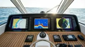
Modern chartplotters often include advanced features like integrated sonar, which adds an extra layer of safety by detecting objects or sea life beneath your boat. Some models even have radar capabilities, helping you see what’s lurking around you, be it vessels in the vicinity or incoming weather patterns.
Another significant advantage of GPS chartplotters is their route planning abilities. You can outline your journey before setting sail, complete with waypoints and safety boundaries. Having these planned routes at your fingertips keeps you prepared for a smooth journey and makes unexpected deviations easier to handle.
The user-friendly interface design is a great help too. Many systems are built with intuitive menus and easy-to-read displays, even when the boat’s rocking. This simplicity in design ensures you can swiftly access critical information, making your time on the water more about enjoying the journey and less about fiddling with complicated settings.
Having all these features packed into a single device not only enhances the safety of your marine ventures but also adds convenience. It’s like having a co-pilot who not only knows the waters but also predicts what lies ahead. These chartplotters reduce the stress of navigation while increasing confidence, enabling you to venture further and explore more with peace of mind.
An In-Depth Guide to Chartplotter Setup and Usage
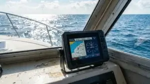
Setting up a marine GPS chartplotter might seem daunting at first, but a methodical approach can simplify the process. The first step is mounting the device securely, ensuring it’s accessible yet doesn’t obstruct your line of sight at the helm. Choose a position that minimizes glare and offers optimal visibility.
Once mounted, powering up the chartplotter and connecting it to external sensors, such as depth finders or radar, is crucial. This connection allows the device to provide comprehensive information beyond simple GPS positioning.
Calibrating the screen is an often-overlooked step that makes a world of difference. Make sure the brightness and contrast settings are adjusted so the display is easily readable in various lighting conditions, from bright sunlight to overcast days or nighttime settings.
Next, the tutorial begins with loading and updating the maps. Most chartplotters require you to install digital charts of the areas you plan to navigate. Keeping these maps up to date is essential for accurate navigation, as waterways can change with new developments or natural shifts.
After setup, familiarize yourself with the interface before setting sail. Spend some time exploring the menu options and understanding how to set waypoints, plot routes, and access integrated features like weather forecasts or sonar readouts.
For a smoother experience, learn to customize your chartplotter’s settings to fit your specific needs. This can include setting alarms for shallow waters or approaching waypoints, which help in proactively managing your journey.
Regular checks and updates are vital. Firmware updates can enhance the performance or fix known issues, ensuring your chartplotter continues to operate efficiently. With these steps, you ensure your chartplotter is a reliable instrument that enhances your maritime adventures.
Navigating with Confidence: How to Use a Chartplotter Effectively
When you’re out on the water, knowing how to use a marine GPS chartplotter effectively can transform your boating experience from stressful to serene. Start by routinely practicing with your chartplotter in familiar waters until you feel comfortable using its various features.
One of the most powerful tools at your disposal is waypoint navigation. By setting waypoints, you can chart out a planned path that guides you to your destination with precision. It’s essential to regularly check and adjust your course as conditions change to stay on track safely.
The route planning function helps you prepare for just about any scenario. Plotting your route beforehand allows you to anticipate obstacles, including tricky waters or areas with heavy traffic. This foresight enables you to make informed decisions when unexpected situations arise.
Incorporating weather data from your chartplotter can also greatly enhance safety. Many devices offer real-time weather updates, allowing you to adjust your plans to avoid severe conditions. Staying updated with the weather helps maintain a smooth journey and avoids unnecessary risks.
Effective use of radar and sonar integration can be a game-changer, particularly when navigating in less familiar waters or poor visibility conditions. Learning to interpret these data visuals ensures you’re not caught off guard by submerged obstacles or other vessels.
In challenging conditions, your chartplotter’s alarm functions come into play. Set proximity alerts for approaching shorelines or uncharted waters to keep you well-clear of any trouble.
Remember, practice makes perfect. The more you use and explore your chartplotter’s capabilities, the more intuitive navigation becomes, boosting your confidence and opening up new waters to explore.
Making the Right Choice: Choosing the Best Marine GPS Chartplotter
Picking a GPS chartplotter can be overwhelming given the sheer number of options, but narrowing it down starts with understanding your specific needs. Consider where you’ll be doing most of your boating. Coastal or offshore trips may require more advanced features like radar or sonar integration.
The size of the display is also crucial. Larger screens are easier to read at a glance, which can be a game-changer when conditions are less than ideal. However, balance this with the space available on your vessel to ensure it doesn’t obstruct your view or controls.
User interface is something to pay attention to. A chartplotter should have a layout and controls that match your comfort level. Touchscreens can be great, but make sure buttons are large enough and intuitive to use, especially if you’re often wearing gloves or if the screen might get wet.
When looking at different models, consider the maps they support. Some chartplotters offer worldwide charts, while others may be more regionally focused. Check if map updates are easy to manage and if there are ongoing costs for these updates.
Budget is always a key consideration. While it’s tempting to go for the latest and greatest, it’s essential that the device fits your financial plan. Refurbished models from reputable dealers can offer good value without compromising on quality.
Pay attention to connectivity options, such as Wi-Fi or Bluetooth, which can facilitate easy updates and integration with other marine electronics onboard, like fish finders or wind sensors.
Lastly, tap into consumer reviews and expert opinions. Buyers often reveal insights about real-world performance and durability that aren’t covered in manufacturers’ brochures, giving you a clearer picture of what to expect. This comprehensive overview helps you find a chartplotter that truly enhances your boating adventures.
Maximizing Your Marine Experience with GPS Chartplotter Tips
To truly make the most of your marine GPS chartplotter, there are some useful tips and tricks that can enhance both your navigation experience and safety on the water. One effective strategy is regularly updating your device’s firmware and maps. This ensures your chartplotter has the latest features and corrected chart details, keeping you on a safe course.
Routine maintenance is key. Make it a habit to check the connections and ensure the device is firmly secured. Loose wires or fixtures may lead to intermittent connectivity issues, compromising the reliability of your data when you need it most.
Customizing your chartplotter’s settings can also improve your experience. Set up personalized data fields based on what you find essential, whether it’s fuel range, arrival times, or tides. By tailoring these settings, your display delivers information at a glance without sifting through menus.
Another tip is to make full use of the man-overboard feature, which allows you to mark the exact location if someone falls overboard. Familiarize yourself with how to quickly activate this feature, making sure everyone on board knows how to use it too.
Explore different mounting options if your boat’s layout changes or if you upgrade your console. A flexible, movable mount allows you to position the chartplotter for optimal viewing, regardless of where you need to be in the boat.
Finally, stay informed about emerging trends in chartplotter technology. Innovations such as augmented reality or remote monitoring could open new possibilities in marine navigation, keeping you at the cutting edge of what’s possible at sea.
By applying these practical tips, your chartplotter becomes not just a navigational aid but an integral part of a seamless, safe, and enjoyable boating experience.
As an Amazon Associate I earn from qualifying purchases.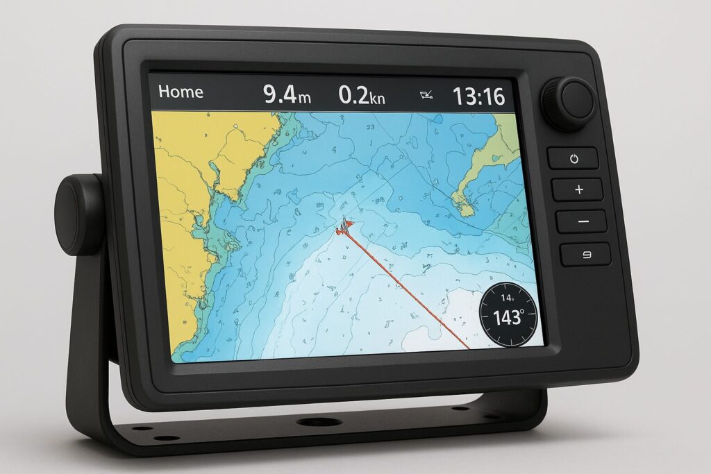

Thank you for this incredibly detailed overview. As someone who made the switch from paper charts to a full chartplotter system, I can confirm every point here. The section on “Navigating with Confidence” is so true—the ability to pre-plan routes and have that safety net of real-time data completely changes the boating experience, reducing stress and letting you enjoy the journey more. The tip about practicing in familiar waters is golden advice for new users!
Regards
Oren
Hi Oren,
Thank you for sharing your experience—it’s great to hear how the transition to a chartplotter system has made such a positive difference for you. I couldn’t agree more that having the ability to pre-plan routes and rely on real-time data really transforms the whole boating experience. And yes, practicing in familiar waters is such a simple but powerful way to build confidence!
Wishing you many more safe and enjoyable journeys on the water.
Best regards,
Andrejs