Welcome to my all-in-one FAQ guide on advanced marine navigation devices. I’m sharing practical answers to questions you might have if you’re looking to update your marine electronics, want to understand your options, or just want a clear explanation of how these systems work out on the water.
Q1: What are advanced marine navigation devices?
Advanced marine navigation devices are electronic tools designed to help me plot courses, pinpoint my location, and travel safely on the water. These devices include GPS chartplotters, radar systems, sonar (fish finders), Automatic Identification Systems (AIS), and integrated multifunction displays. Each device serves a specific role in helping me avoid hazards, find the shortest or safest route, and manage real-time conditions while boating. I rely on these tools for accurate information, especially in unfamiliar waters or rough conditions. In recent years, these devices have gotten smarter and more connected, giving everyone from casual boaters to seasoned sailors peace of mind.
Q2: How does GPS navigation work on a boat?
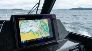
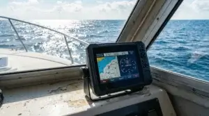
GPS navigation uses signals from satellites orbiting the Earth. My marine GPS unit receives these signals and calculates my exact position using latitude and longitude. A chartplotter then overlays my position on a digital map, so I see exactly where I am at all times. If I enter a destination, the device can plot a suggested course, showing me distances, possible hazards, and important waypoints. This technology gives me a real-time, zoomable map right at my helm, helping me stay on track and avoid obstacles. Thanks to continual improvements in satellite technology and mapping software, GPS devices are more reliable and accurate than ever before.
Q3: What features should I look for in a modern chartplotter?
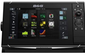
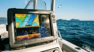
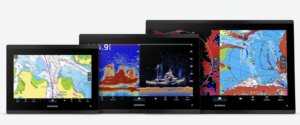
A good chartplotter offers high-resolution color screens, responsive touch controls, and the ability to show multiple information layers at once, such as chart data, radar returns, and sonar images. Many units allow me to customize my display so I can quickly switch between map views, depth charts, or weather overlays. Important features include preloaded maps (with options to update or expand coverage), compatibility for networking other devices, Wi-Fi or Bluetooth for syncing with phones or tablets, and backup battery or integrated power management. I pay close attention to screen brightness as well, since clear, glare-free visibility is really important on sunny days. Some chartplotters now even support voice commands, making hands-free operation possible, which is great when I’ve got my hands full on deck.
Q4: How does marine radar help with navigation?
Marine radar sends out radio waves and receives the echoes bounced off objects around my boat. It shows me nearby vessels, coastlines, buoys, and even rain squalls on a display. In fog, rain, or nighttime conditions, radar helps me see obstacles that aren’t visible to the naked eye. Modern digital radar systems have reduced false echoes and can display sharp, detailed images, letting me track moving targets as well as fixed hazards. I use radar to keep a safe distance from other boats and to alert me if something is in my path. With the latest radars, features like bird mode even help fishermen spot flocks of seabirds and, indirectly, schools of fish.
Q5: What does a fish finder or sonar do?
A fish finder, also known as sonar, uses sound waves to scan the water beneath my boat. The device sends sound pulses downward, and when those waves hit something (like a fish, rock, or the seabed), they bounce back to be interpreted as images or data. I use this information to gauge water depth, spot schools of fish, or avoid underwater structures that could damage the hull. Some models also map bottom contours, which helps with anchoring or understanding the underwater environment. Recent sonar technology includes side scanning and 3D imaging that give a detailed look at the underwater world, making navigation and fishing much easier and more precise.
Q6: Why would I use an Automatic Identification System (AIS)?
The Automatic Identification System (AIS) broadcasts my boat’s information, such as its name, type, position, course, and speed, to other AIS-equipped vessels and shore stations. It also receives this data from others nearby. On a chartplotter or AIS display, I see moving icons representing other boats, which really helps me avoid collisions, plan passing maneuvers, and understand traffic density in busy waterways. AIS can also help emergency responders locate me quickly if I need assistance. Besides that, AIS data lets me check the identity and intentions of nearby ships, making navigation safer in crowded or restricted waters.
Q7: How do integration and networking improve navigation devices?
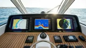
Integration means different devices on my boat can share information with each other. For example, my GPS, radar, sonar, and AIS may all feed data to a multifunction display, giving me a unified view. Some systems allow remote control or monitoring from a smartphone or tablet, giving me more flexibility while on deck. Networking makes it possible to add on components as my needs change, such as weather receivers, autopilot systems, or extra sensors. With everything connected, I make informed decisions without switching between lots of screens or controls. This interconnected setup is especially useful when handling large boats or sailing in unpredictable conditions, since I want all critical information at my fingertips.
Q8: What is a multifunction display (MFD) and how does it help?
A multifunction display, or MFD, acts as the central hub for all my navigation electronics. It combines maps, radar, sonar, engine data, and often even entertainment controls on one screen. I can split the display to see radar and GPS maps side by side or overlay radar images on the chart. This setup saves space, reduces clutter, and keeps important information close by. With a touchscreen interface and customizable settings, I arrange the data in the way that suits me best for any situation on the water. The flexibility of an MFD means I can choose exactly what I want to see, depending on whether I’m fishing, cruising, or navigating through tricky areas.
Q9: Are marine navigation devices hard to install and maintain?
Most advanced marine electronics are designed with user installation in mind, but wiring, waterproofing, and making sure the right placement for antennas or transducers can be a bit technical. I usually follow manufacturer manuals closely or reach out to qualified marine technicians for more complex setups or integrations. Maintenance is low once installed; I keep screens clean, update my charts and software regularly, protect wiring from corrosion, and check that sensors are free of algae or debris. Keeping everything working smoothly helps me rely on my gear every time I head out. In addition, checking for software or firmware updates every few months helps prevent unexpected issues out on the water.
Q10: How important are software updates and digital charts?
Providers release regular software updates to add features or fix bugs, and they keep digital charts current as coastlines, buoys, reefs, and regulations change. I check for chart updates at least once a season, especially before a long trip. Up-to-date charts decrease the risk of running aground or missing new hazards. Many devices support downloads via Wi-Fi or computer, which makes it easy to keep my system accurate and reliable. Regular updates also bring improvements in speed, map clarity, and sometimes even add new forecast or safety features to my navigation platform.
Q11: Can I use a tablet or smartphone as my main navigation device?
Tablets or smartphones running navigation apps offer a portable, userfriendly backup to built-in marine hardware. With GPS chipsets and access to detailed charts, they give me flexibility for trip planning and real-time navigation. However, I still rely on properly installed devices for all-weather use, especially in rough conditions where waterproofing, sunlight visibility, and system integration are really important. Mobile devices are great as a supplement and for redundancy, but I don’t bank on them as my only navigation method. If you try this route, consider protective cases and battery backups to keep running as long as you need.
Q12: What are the benefits of digital vs. paper charts?
Digital charts are easy to search, update, and zoom. I switch between different chart types in seconds, measure distances on the fly, and see my boat’s position in real time. Paper charts require manual plotting and are slower for route planning, but they never lose power. I keep paper charts as a backup in case of electrical failures, making sure I can still find my way if something goes wrong. Using both methods together covers all my bases and gives me peace of mind, especially on long or remote trips. Many boaters suggest learning to read paper charts and practice plotting courses there too, so you’re not left high and dry if all else fails.
Q13: Are there specific devices recommended for sailing, fishing, or yachting?
The type of vessel and typical waters I use make a real difference in my equipment choices. Sailors often prefer lightweight chartplotters and wind sensors. Anglers focus on sonar and fishfinding features, like sidescanning or downimaging. Yacht owners tend to invest in large MFDs, radar, and complete integration. I always look for units with solid water resistance ratings, sunlight-readable displays, and a support network for chart updates. Thinking about my regular activities ensures I pick the devices that make sense for my style of boating. Don’t be afraid to ask other boaters what has worked for them—most are happy to share real-world experience, which can save you time and money.
Q14: How do I stay safe using marine navigation electronics?
Navigation electronics help me plan and avoid danger, but staying alert and following basic seamanship is really important. I check settings before leaving the dock, keep an eye on the horizon, never rely on electronics alone, and always have a backup plan. I also teach anyone joining me on the boat how to use the equipment in case of emergency. Practicing with my devices on calm, clear days helps me get comfortable and spot errors quickly if something feels off while I’m underway. Safety on the water is a combination of common sense, good tools, and frequent practice.
I hope this guide gives you a good sense of what advanced marine navigation devices can do and how I use them to make boating safer and more enjoyable. For more details, I often check product guides, boating forums, and official resources like the US Coast Guard’s recommendations and websites specializing in marine electronics. If you still have questions, don’t hesitate to ask experts at your local marine electronics shop.

