Time-lapse tracking of fishing routes offers a smart way for anglers to turn their daily outings into useful maps and learn where the best bites happen. By using GPS and modern tracking apps, I’ve found it’s possible to review an entire trip, see where I spent the most time, and spot patterns that help me fish better in the future. If you’re curious about bringing new tech onto your boat, whether you fish for fun or run a small operation, having the right tools for route tracking makes each trip count for a lot more.
What Is Time-Lapse Fishing Route Tracking?
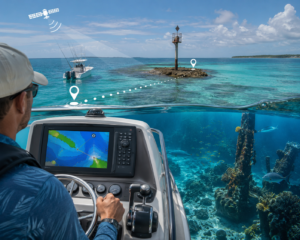
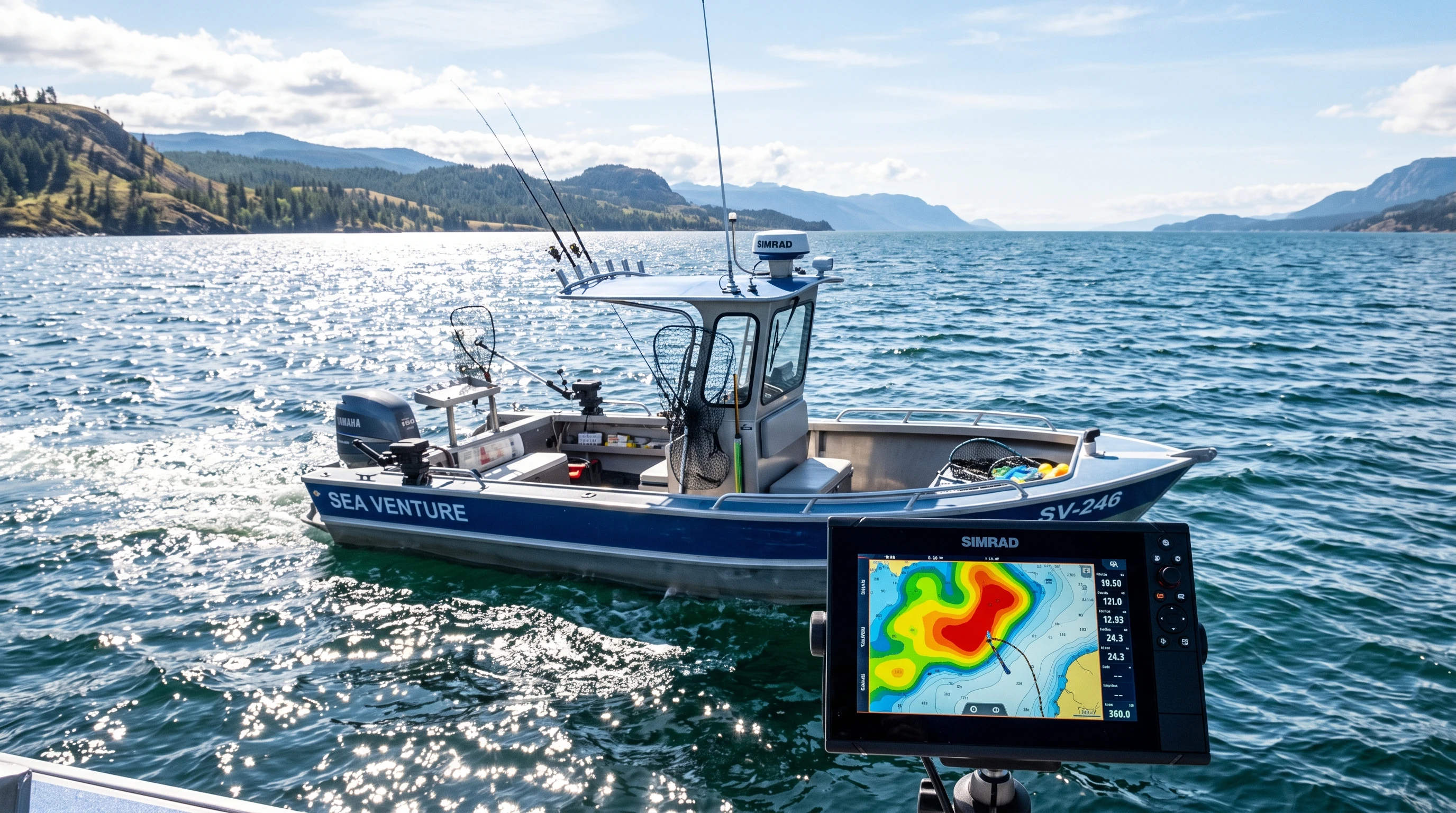
Route tracking technology for fishing means recording your boat’s movement throughout a trip by using GPS logs and time-stamped data. When I run my tracking app, it collects a steady stream of location “pings.” With time-lapse features, these pings get stitched into a sped-up visual—almost like a fast-forward replay of my day on the water. This creates not just a simple squiggly line but a digital record that helps me recall every drift, stop, and pattern change. GPS alone shows where I went, but matching these pings with timestamps and fishing activity paints a much clearer picture of why some days work better than others.
Most time-lapse tracking setups use a smartphone, fishfinder, or chartplotter equipped with route-logging software. The app records my route every few seconds, drawing a line or heatmap on navigational charts. When I’m back home, or even during a break on the boat, I can replay the entire session, watching my route zip around the screen to spot productive areas.
Innovative Fishing Route Mapping: From GPS Data to Heatmaps
Basic GPS logs show a single line tracing your boat’s movement. Time-lapse tracking goes further by layering my movements over time. The more I linger in a spot, the bolder or “hotter” it appears on the map. These heatmap overlays turn hours of raw data into a colorful visual showing which stretches of water attracted the most attention.
If you tag fish catches in your log, each strike can appear as a pinpoint or symbol. This takes the guesswork out of reviewing big trips. I like to compare my time-lapse trail to known structures, drop-offs, and points. Where I see bright clusters of color, there’s usually a reason; either bait was active, the wind pushed in food, or fish simply stacked up. Over repeated trips, these maps help me figure out when and where the fish show up and how weather or time of year affects their movement.
How to Track Fishing Routes: A Step-By-Step Guide
Getting started with timelapse route tracking is pretty straightforward if you use smartphones or GPS units. Here’s how I start logging and reviewing my routes as a beginner:
- Pick Your Tracking App or Device: Download a timelapse-capable app (like FishTrack, Navionics, or ANGLR) or use a compatible GPS/chartplotter.
- Enable Location and Trip Logging: Make sure your device’s GPS is turned on, and start a new track at the dock or launch site.
- Fish as Usual, Tagging Catches: As you move around, the app logs your route. Tap to “tag” notable events, such as strikes, lure changes, or areas with lots of activity.
- Finish and Save: When your trip ends, save and name the route for easy future access.
- Review and Replay: Use the timelapse playback function to watch your session in fast-forward. Check the map, heatmaps, and any popups for tagged catches.
Most apps also let me export my route data. I often back up my trip logs, so I can look for longer-term patterns down the road. If you’re aiming to get more from each outing, this archive builds up a personal fishing database to check back on across seasons.
Best Time-Lapse Fishing Route Apps Compared
Plenty of fishing route apps pack in timelapse features, but each app has its own strengths depending on what you need. Here’s a comparison of popular options I’ve tried or researched:
| App | Route Replay Speed | Catch Tagging | Offline Maps | Data Export |
|---|---|---|---|---|
| ANGLR | Customizable playback | Tap to log catches, weather, photos | Yes | GPX and CSV format |
| Navionics Boating | Timeline slider | Pin drops and notes | Yes | GPX export |
| FishTrack | Quick route playback | Manual event log | Downloadable charts | KML/GPX export |
| FishAngler | Live timeline map | Automatic weather + catch log | Yes | CSV/JSON options |
When choosing, I focus on how quickly I can tag catches, how easy it is to replay the trip, and if the app works without a cell signal. Exporting data is useful if I want to check routes in desktop mapping software later. Some anglers want social features, while others keep their routes private; most major apps allow you to set privacy preferences for peace of mind.
Fishing Route Analysis Software: Digging Into the Data
Beyond simple replays, some software lets me get really hands on with the numbers and patterns. Exported GPS logs include lots of details, such as speed, position, timestamps, and sometimes depth if connected to a sonar. By importing this data into analysis programs like Google Earth, ArcGIS, or QGIS, I can:
- Calculate total distance covered and time spent on the water
- Pinpoint areas where I drifted slowly, which often means I saw active fish or tricky conditions
- Overlay catch locations with weather or tide info
- Look for depth or temperature patterns tied to fish catches
Some fishfinder and chartplotter brands, such as Lowrance or Garmin, offer their own software for visual route analysis. The insights are especially good for people running multiday trips or comparing results from different lakes or seasons. Learning how to read these maps can take a bit of practice. However, I’ve found that spotting even one or two clear trends often leads to better days the next time I’m out. The cool part? Sharing anonymized findings with other anglers sometimes leads to friendly tips and new approaches.
Time-Lapse Fishing Techniques: Spotting Strikes and Patterns
When I replay a fishing trip in timelapse, it’s like seeing the whole day unfold in a couple of minutes. The magic comes when I match the route with tagged photos or notes about each catch. Watching a route trace over underwater structure, drop-offs, or creek mouths, and seeing exactly when the action picked up, gives real feedback on my approach.
Some anglers use route playback to home in on:
- Which points or bends produced strikes when the boat slowed down
- How wind or current affected boat drift and lure presentation
- What time of day was most productive across multiple trips
Because the whole day is logged by the minute, I can check exactly where and when I should have adjusted course or shifted tactics. Over time, this helps me build a repeatable process and avoid wasting time in less productive spots. I like to use this information to update my strategy for future trips, especially during peak seasons.
Fishing Route Optimization Strategies Using Time-Lapse Data
Having several time-lapse recordings of fishing trips lets me plan better for the next outing. Here’s how I use past data to make new trips more efficient:
- Match productive routes from previous trips to decide where to start fishing
- Avoid unproductive drifts or detours, which saves fuel and time
- Notice if certain stretches of water are busy at the same hour on different days
- Adjust timing for approaching favorite spots to line up with bite windows
Route tracking lets me focus less on guesswork and more on actual fishing. The more I use these records, the easier it becomes to stick to areas that hold fish instead of covering water randomly. Some anglers set up seasonal waypoints and use last year’s timelapse heatmaps to repeat successful routines year after year. If you want to step up your fishing game, checking these patterns can give your approach a serious boost.
Fishing Route Mapping for Beginners: Simplifying Tech and Jargon
Starting with fishing route tracking can seem complicated, especially with so many new terms and device options. Here’s how I’d break it down in plain language:
- Tracking App or Device: Most smartphones or modern GPS fishfinders can record your path. Download a free or low-cost tracking app to try things out.
- Recording a Trip: Hit “start” as you launch. The app follows your route using GPS.
- Tagging a Catch: Tap a button or add a note every time you catch something or change lures.
- Reviewing the Route: After fishing, view your map and watch the route replay. Look at where you slowed down, sped up, or caught fish.
- Starter Gear: For under $50, you can get a waterproof phone case and a reliable fishing app. If you have a fishfinder with GPS, check if it records routes before upgrading.
You don’t need a bunch of fancy equipment to get the benefits. I started out with a free app and found that learning how my movement matched up with my fishing results taught me more than just remembering “that one good spot.” It’s a practical way to build skills and boost confidence on the water.
Fishing Route Tracking for Conservation and Sustainable Fisheries
Route tracking data does more than just help individual anglers catch more fish. When lots of users submit anonymous fishing routes and catch data, the information builds a wider picture of how much pressure different areas receive. Fisheries managers use these datasets to:
- Identify heavily fished places that might need stricter limits or new access regulations
- Spot trends in angling activity affected by weather, access, or new laws
- Support better restocking, habitat recovery, or season timing based on actual use patterns
Some tracking apps offer programs that let you opt in to share anonymous route and catch data for conservation science, not for marketing. I choose to participate because keeping fisheries healthy benefits everyone long-term. When anglers pitch in, we help balance good fishing today with having plenty of opportunity for seasons to come. By staying informed, we all help keep our favorite waters abundant for the next generation.
In short, using time-lapse route tracking can transform how you approach fishing, both by improving your own results and by contributing to the community. Whether you’re aiming to build better personal maps, learn subtle patterns, or help conservation efforts, tracking your fishing routes is a smart move that brings modern technology onboard for a better angling experience.
This article was created with AI assistance and reviewed by a human editor.
About The Author