Using a GPS device can really change the way you plan your fishing trips. I remember when I first started fishing, I would wander around looking for that perfect spot. Now, with a GPS, I’m able to pinpoint the best locations and track my journeys on the water. This all-in-one guide lays out how I use GPS for fishing spots and how you might get started on your own adventures.
Maybe you’re new to GPS technology or you just want to improve your current setup. The good news is that understanding your device and its potential can help you locate fish better and navigate with more confidence.
In this article, I share practical steps and tips for turning your GPS tool into a dependable fishing companion. From understanding your GPS device to managing your saved spots, the methods discussed can help any angler get the most out of their technological investment.
Step 1: Understand Your GPS Device and Its Features
The first step in using a GPS effectively is to understand the device you’re working with. Whether you’re using a dedicated handheld unit, a smartphone app, or a multi-function device, knowing its capabilities is vital.
Getting Familiar with the Basics
Every GPS device offers features like satellite connectivity, waypoints, and route tracking. Spend some time reading through the manual. This helps you learn how to mark locations and navigate between them without confusion later on.
Features to Look For
- Waypoint marking: This lets you tag a location, such as that secret fishing hole where you caught your biggest fish.
- Route planning: Check out how to plot a course over water. This is particularly useful for longer trips or when exploring unfamiliar areas.
- Display clarity: Make sure the screen is easy to read under sunlight and that the battery life is sufficient for your outings.
- Waterproof capability: Since you’re out on the water, a waterproof or water-resistant device is a practical choice.
Once you know your device inside out, it’s easier to use it with confidence when you’re out fishing. Experiment with its functions before you kick things off on a long trip so that you can learn from any minor hiccups in a safe setting.
Step 2: Setup and Customize Your GPS Maps for Water Navigation
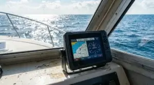
For fishing, standard road maps won’t do. What really makes a difference is having detailed water charts and nautical maps available on your GPS. Many modern devices and apps come with pre-loaded maps for lakes, rivers, and coastal areas.
Downloading Detailed Water Charts
Start by checking if your GPS supports water navigation maps. Some manufacturers offer downloadable maps that show underwater structures, depth contours, and other key features that might indicate fish habitats. If your device doesn’t already include such maps, look online for resources tailored to anglers.
Software Updates and Calibration
Regularly update your device to ensure it has the most current maps and software improvements. I always update my GPS before a new fishing season. Calibration is also important so that the device accurately reflects your current location on the water. This can often involve simply syncing with a known point or running a quick calibration test.
Take time to experiment with different map layers. For example, some devices allow you to overlay weather conditions, tide charts, or water depth. This extra layer of detail can help you get a sense of the underwater terrain and decide where fish might be holding.
Step 3: Marking and Saving Your Favorite Fishing Spots
One of the greatest advantages of using a GPS comes from the ability to mark and save spots that have worked well. After a successful catch, you can tag that specific location. Over time, these waypoints build into a valuable map of your personal fishing treasures.
How to Mark a Spot
Learn the process for marking a waypoint on your specific device. This usually involves selecting a ‘mark location’ button or icon. Once the spot is saved, you can add notes or even rate how productive the spot was.
Organizing Your Saved Locations
As the number of saved spots grows, keeping them organized is key. I like to group spots by water body or region so that when planning a trip, I’m not overwhelmed by a long list. Some devices even let you color-code waypoints to indicate different types of spots like trolling grounds, bait locations, or safe anchorage points.
- Create folders for each body of water.
- Use custom icons if available in your app.
- Add detailed notes so that you remember the conditions—like time of day, tide, and weather—when the spot was most productive.
By keeping an organized record of your fishing spots, you can spot patterns such as where fish like to gather during certain seasons or under specific weather conditions.
Step 4: Use the GPS to Plan and Track Your Fishing Routes
Beyond just marking spots, I find that planning entire routes can make a huge difference in how a fishing trip unfolds. This lets you optimize the path you take and ensures you cover areas that are known to be productive.
Mapping Out Your Adventure
Before you set out on a trip, take time to plot the route you intend to travel. Using your GPS, mark both your starting point and the sequence of waypoints you plan to visit. This is especially handy if you’re exploring a large lake or river with multiple potential fishing spots.
Creating Custom Routes
Many devices allow you to create routes that you can save and reuse in future trips. I’ve used this feature to plan my multi-spot excursions. The option to see your path and distance traveled helps you manage fuel if you’re using a boat motor and also keeps you from accidentally wandering off course.
Mapping routes isn’t just about getting to the spots. It’s also about timing. Consider the movement of tides, the rise and fall of the water level, or weather patterns that might affect your adventure. Combining these factors with your GPS route planning gives you a strategic advantage on the water.
Step 5: Integrate Additional Tools and Data with Your GPS
Today’s GPS devices are more than just location trackers. They can often integrate with other tools that provide valuable environmental data. This extra information is super useful when you’re trying to determine the best fishing conditions.
Understanding Tide and Weather Data
In many coastal and lake regions, tides play a major role in determining fish behavior. Some GPS devices or associated apps can display tide schedules along with wave height and wind direction. This extra layer of data helps you decide the best time to fish at a particular spot.
Using Depth Finders and Sonar Integration
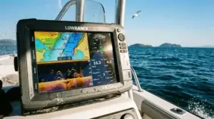
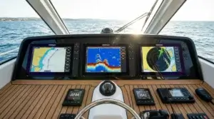
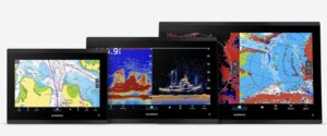
If you have a depth finder or a sonar accessory, some GPS units let you overlay this data onto your maps. This can highlight underwater structures like drop-offs, sandbars, or rocky outcrops. I’ve found that combining sonar data with GPS mapping gives me a clearer picture of where fish might be hiding.
Other useful integrations might include water temperature readings or current data, although these tend to be found in more sophisticated setups. The key takeaway is to use every tool available to get as complete an understanding of the fishing environment as you can.
Step 6: Maintain a Systematic Log of Your Fishing Adventures
Keeping track of your fishing experiences on the water can pay off big time. Not only does this log help you remember where you had success, but it can also inform your decisions over time as patterns emerge.
Creating Your Fishing Log
I like to use the notes feature available on many GPS devices. After finishing a session, I record details such as water conditions, weather, tide levels, and any peculiarities about that spot. Over time, these notes form a super detailed guide that grows more valuable with every trip.
Using Logging Apps or Software
While many GPS devices come with a built-in logging feature, you might also consider dedicated fishing log apps. These apps allow you to enter more details and even sync with your GPS data. They might let you tag photos, record temperatures, and include other environmental information. I find it helpful to review these logs before heading out on subsequent trips.
- Include weather and water conditions.
- Record the types of fish caught at each spot.
- Track any changes in location over time.
Having a detailed account of your fishing trips not only serves as a personal record but can also highlight trends that might indicate the best spots for different times of the year.
Step 7: Troubleshoot and Adapt as Needed
No system is without its challenges. GPS devices, like any piece of technology, can sometimes encounter issues. Whether it’s a weak satellite signal or an outdated map, it helps to know a few troubleshooting strategies.
Troubleshooting Common Issues
- Weak signal in remote areas: Often, this can be improved by moving to an open area or simply waiting a few minutes for the device to re-sync with the satellites. I always check the satellite status before leaving the dock.
- Software glitches: Sometimes a simple restart of the device clears up issues. Make sure your device’s firmware is regularly updated, as manufacturers often roll out fixes for common bugs.
- Misaligned waypoints: If you notice that your saved waypoints don’t match up with known landmarks, recalibrate your device. Double-check your GPS settings to ensure that your coordinate system is set correctly.
Adapting to Changing Conditions
The conditions on the water can change quickly. I always have a backup plan in case my primary set of saved locations becomes unreliable. This might include marking a few extra waypoints along a different route or having several GPS devices on board. Flexibility is key when working with natural environments.
Communication with other anglers can also be invaluable. Sometimes sharing information about GPS coordinates and recent changes in water conditions can help everyone get more accurate results. If something unexpected happens, be ready to adjust your course.
Common Questions & Troubleshooting
What if My GPS Device Struggles with Signal Strength While on the Water?
Even the best devices might have issues with satellite reception, especially in remote or heavily forested areas near lakes. To improve signal strength, make sure your device is placed in an area with a clear view of the sky. If you’re on a boat, avoid obstructions like tall masts or canopies. Sometimes simply pausing and letting the device reconnect can make a big difference.
How Do I Share My Favorite Fishing Spots with Friends?
Many modern GPS devices and apps let you export your saved waypoints. Often, you can share these via email or through a dedicated app. I find that sharing my best spots not only helps fellow anglers but also sparks feedback that might refine the accuracy of my saved locations. Make sure everyone is using similar coordinate systems to avoid confusion.
What if I Accidentally Overwrite or Lose My Saved Waypoints?
This is a common worry. Regular backups of your GPS data can prevent loss of information. Many devices allow exporting of waypoint data to a computer or cloud service. I recommend backing up your spots after each major trip so that you never lose track of your hard-earned data.
Final Thoughts & Next Steps
A GPS device can truly revolutionize your approach to fishing. With the ability to pinpoint locations, plan routes, integrate extra environmental data, and keep detailed logs, you’re well-equipped to give a boost to your time on the water. Using GPS for fishing is not only about technology. It is also about learning more about the environment you are exploring. Making each trip as productive as possible requires preparation, careful planning, and a willingness to adapt.
Your Action Plan
- Spend some time getting familiar with your GPS device. Read the manual, explore its features, and mark a few test waypoints in a safe setting.
- Upgrade your maps. Download detailed water charts, update your device’s software, and experiment with overlaying additional data like tide and depth information.
- Create a personal system for marking, organizing, and logging your fishing spots. This might mean using folders, custom icons, or even a dedicated fishing log app.
The more you practice and integrate these steps, the more natural the process becomes. Soon enough, you’ll have a personalized map of all the spots that provide the best fishing experiences. What’s one new feature or tip you plan on trying out during your next fishing trip?
Extra Tips for Advanced Anglers
If you’re looking to take your fishing game to the next level, consider exploring some advanced techniques that can really give your adventures an extra boost. Many experienced anglers have found that developing a routine for checking and fine-tuning their GPS devices not only prevents issues but also opens up opportunities to uncover hidden gems on the water. Regularly investing time in reading firmware updates, online forums, and user experiences can help you make use of every feature your device offers.
It’s very important to maintain your equipment. Keeping your GPS device in top condition means checking the battery frequently, cleaning the device after exposure to splashes, and storing it in a dry environment when not in use. Combining these simple maintenance tips with your routine use will ensure that your device is ready to perform when you need it most. Also, consider investing in a sturdy case and screen protector to help keep your device safe during rough weather or bumpy boat rides.
Another great tip is to set aside a little time after each trip to review your logged data. Spend some time going over the notes you took, and compare them with the actual results from your fishing trip. This extra review can reveal subtle hints—like changes in water current or weather—that might impact fish behavior. Over time, these insights can help you plan better trips and even inspire you to experiment with new strategies along your routes.
Additional integrations such as pairing your GPS with a smartphone app for real-time weather and tide updates can also be a game changer. When you mix in these extra data points, you’re not just relying on static maps—you’re tapping into dynamic, live information that can guide your decision-making. This approach has helped many anglers avoid surprises and ensure that each trip is as productive as possible. With every trip, learn something new and continuously refine your methods; after all, every fishing outing is an opportunity to learn and grow.
As an Amazon Associate I earn from qualifying purchases.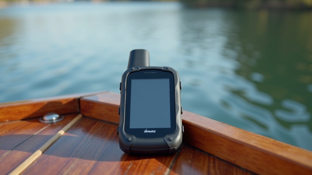

Great walkthrough on squeezing real fishing intel out of a GPS.
I usually drop waypoints in my Navionics app and name them after the lure that scored, but your idea of tagging spots by season is genius—definitely borrowing that
When moving waypoints from a handheld to the console unit, do you lean on SD cards or go the Wi‑Fi sync route? I’ve had mixed luck with both.
Any tricks for backing everything up so the spots survive a factory reset?
Also digging the reminder to note depth and bottom type in the waypoint comments—makes hunting for similar structure so much easier later on.
Thanks for the practical demo!
Thanks a ton — really glad you found the walkthrough useful! Tagging spots by season has been a game-changer for me, especially when patterns shift year to year. Love your method of naming waypoints after lures too — that’s a killer way to track what’s working where.
As for syncing, I still use SD cards more often than not — they’re clunky but reliable. Wi‑Fi syncing has come a long way, but I’ve also had some frustrating moments with app compatibility and dropped connections. When it comes to backups, I always keep a master file of waypoints stored on my laptop and in cloud storage (Google Drive or Dropbox). Exporting them in .gpx or .usr formats gives you some flexibility across platforms and ensures nothing gets wiped in a reset.
And yes—depth and bottom notes in the comments field are pure gold when scouting new areas or revisiting old honey holes. That little bit of detail goes a long way later on.
Appreciate the thoughtful comment!
This was an insightful read. I’ve never tried using GPS for fishing before, but your explanation made it sound both practical and exciting. The idea of marking and organizing waypoints for different water bodies really caught my attention. I can see how that could save time and help identify good fishing patterns. I’d love to learn these techniques, just in case I become a fisherman for income generating. We have that potential in my country to earn more money while helping others get fish.
I also liked your point about keeping a fishing log to track weather and water conditions. That kind of record sounds useful for improving over time. Which GPS brand or app would you recommend for someone just getting started? I also wonder if these systems are to be used in places like South Sudan with issues of infrastructure.
John Monyjok Maluth
Thanks for the kind words, John! I’m delighted to hear you’re interested in using GPS waypoints and a log-system to build your fishing strategy.
For someone just getting started, I’d recommend beginning with a mobile app (low cost, minimal gear) and then, as you grow, considering a dedicated GPS/fish-finder device.
Two good apps to check out:
Fishing Points: allows you to save spots/waypoints, log weather/water data, keep a fishing-log.
Navionics Boating: strong mapping/charting app useful for marking waypoints and exploring structure.
If you later move to a dedicated device, brands like Garmin already support good GPS/fish-finder combos.
About using this system in a country like South Sudan: Yes — it is possible, but you’ll want to keep a few things in mind (battery/power, offline maps, rugged gear etc.). I’d be happy to walk through what to check for your country’s conditions so you can pick something that works well for you and your goals.
If you like, I can pull together a starter list of gear/apps specifically suited for lower-infrastructure areas (battery-friendly, offline capable, affordable) and we can map out how you might structure a fishing plan/log-system that supports your income goals. Would that work for you?