I recently read an article that due to the NATO Operation Joint Warrior GPS signals temporarily will be blocked at Faraid Head and Loch Ewe Between October 5 and October 16.
It made me think how easily, press the button and all of our car navigation, marine navigation GPS, handheld GPS and also so handy smartphone GPS navigation apps are no longer fit for anything, we remain blindfolded.
No matter how it may be sad, but it is a reality. I very much hope that the unpleasant moment would never come, but it cannot be excluded entirely.
I think it is needless to say how such a fact would be obnoxious. The reality may be even very tragic. Modern aviation, ships at sea, cars on the roads and other means of transportation would be mostly paralyzed.
We are so accustomed to the presence of GPS is already the self-evident reality, and we have forgotten how to navigate or find a destination without a satellite navigation aid. To be honest, many even have never known. It is not taught in schools anymore, or almost no longer shown.
I have learned and practical experience how to navigate by the celestial objects and other traditional navigational aids. Meeting today’s seafarers sometimes my heart is trembling seeing that they do not know how to sail other than as just gaze at GPS screen. Maybe occasionally look at the radar and if not lazy take a bearing and distance to obtaining ship’s position.
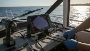
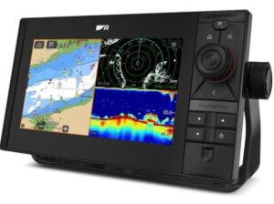
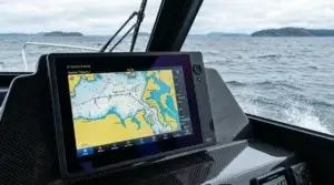
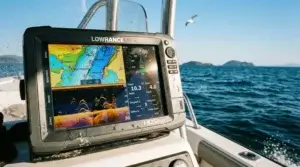
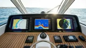
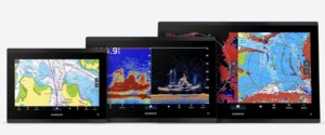
Ships under IMO (International Maritime Organization) rules Today still in most cases have to carry nautical paper charts, they almost no longer be used. Completely understandable is that the electronic chart-plotters are much more convenient. For the sake of justice to say that they are also safer regarding navigation.
Why safer?
Because they are easy to navigate, much more convenient to make adjustments, zooming ability excludes the necessity of changing charts every half an hour simply scroll to next or so. Navigational corrections by Notices to Mariners are available on the automatic online mode to be updated all the time as soon as such corrections take place. Modern electronic nautical charts are integrated with AIS stands for Automatic Identification System. As well as in many cases they are linked to the Internet and can get real-time meteorological data.
Sounds great, Isn’t it? As far as everything on board is in good working condition and as long as the human factor and the error that is often blind obedience in electronics. But, but what about backup. When You last time read a paper road map to find an unknown place to go? Most of us, even myself, a forgotten about them. What problems, my iPhone is full of GPS Navigation Apps. Just touch a screen and choose my favorite one. No internet connection or expensive when abroad, then find offline GPS application as maps.me or TomTom.
We have to accept the fact that many knowledge has forgotten or even never known. Life goes on and tries to live as best as possible and more cheerful. Not so hopeless in my above-described topic. Although I find my old paper maps or even better buy new ones and drop in my car, who knows?
Let’s step back to satellite navigation systems. Today already there are other, not just GPS. Russians for several years operated GLONASS, stands for Globalnaya Navigatsionnaya Sputnikovaya Sistema, Which MEANS global navigational satellite system.
This time I do not wanna talk about the popularity and performance, but just want to say that many manufacturers in their satellite navigation receivers already uses both GPS and GLONASS. Even more, smartphones as Apple started inputting GLONASS beginning with the iPhone 4s. The same applies to Samsung, HUAWEI, Motorolla, HTC, LG, Sony, Sony Ericsson and others.
Even better, as hopefully, the European Union is about complete the Galileo satellite navigation system‘s constellation shortly. And even now, mainly Chinese, setting up the sat nav receiver tools which can receive and understand the signals of all three systems.
Such multi satnav solution is taking place in fleet tracking systems. For example, the “Fleet GPS Tracker + GLONASS support T3” includes even GSM tracking feature. But “STEPP III / TFOX-LT”is equipped with GPS, GLONASS and Galileo satellites receivers.
So the Future is not so irredeemable as it seemed at the beginning. But, when we are lost in the woods or on the high seas are left without GPS navigation than finding between your belongings the good old paper maps and a compass, a little refresh the memory and, believe me, that the beloved coastline is not so far.
Good luck and take care!
————————————————————————————————–
Be careful when driving by GPS navigation in some countries
Today October 7, 2015, I came across on a very sad story which proves not always blindly to trust the GPS navigation.
Around the 70-year-old couple was underway to a popular beach in Rio de Janeiro in Brazil. To reach the destination they following WAZE GPS navigation app directions. Instead, to get to the beautiful beach GPS navigation led them to drive one of the most dangerous areas of Rio Caramujo. There, the car was fired about 20 bullets.
The man remain unwounded was able to drive away. But the woman died after suffering a heart attack at a local hospital.
“Unfortunately it’s hard to prevent drivers from navigating to a dangerous neighborhood if it’s the destination they select” said Waze, a Google-owned company, in a statement.
Sadly, and I expresses my condolences to the relatives.



This is a site that can come in handy when one is lost. Being stuck and stranded is a thing of the past and now that there is GPS no one has to use those old maps. I remember my dad using those every trip we went on, and boy o boy am I glad I never had to use one!!! I also enjoyed reading about the importance of understanding what to do if we didnt have technology! Great Site!
Thanks! For those paper maps maybe somewhat overstated. We live, however, in the 21st century. But time and again have heard about people who are lost in the woods or left without a landmark on the high seas.
Wow that really makes you think of how dependent we are our our technology. I think its great your spreading the world on old techniques of navigation for those who may need it. I hope I’ll never need it tho haha. I hope to hear more from you and other ways to navigate than GPS.
Thank you Mark for your feedback. It’s not so terrible in reality. Not so long ago we follow the road signs and instructions. Naturally, listen to the voice instructions from the GPS navigator is much more convenient, but we could come to your destination even without it. Maybe sometimes it takes just a bit longer.
It is really unpleasant thing if the car navigation may lead you into such a dangerous spots. To my knowledge, the Waze users can create their own paths. The creators of the application should warn users about potentially dangerous areas, in particular as criminal city as Rio de Janeiro.
Hello! I’ve used many GPS navigation systems, including Waze app on my iPhone. To be honest, I have never considered this app as serious navigation tool. Also, those reports about road police are often not serious. Police often place themselves on WAZE roads. I know it as I have friends in police