Offshore wind has become one of the fastest-growing sources of renewable energy worldwide, and the machines driving that growth keep getting bigger. Modern turbines now stand more than 250 meters above the waterline, with blades that sweep an area larger than several football pitches. These structures are engineering marvels, but they have introduced an unexpected complication for the boats, crews, and survey teams that work around them: they interfere with satellite positioning. The question of GPS accuracy offshore wind turbines raises has moved from a technical curiosity to a real operational concern, and understanding why it happens is the first step toward working around it.
If you have ever lost a phone signal while walking between tall city buildings, you have experienced a small version of the same effect. Large metal structures and satellite signals do not mix well. Out at sea, where there are no other reference points to fall back on, the problem becomes more serious. This article examines why positioning errors occur near tall offshore turbines, how large those errors can be, what they mean for day-to-day operations, and the practical steps the industry is taking to keep crews and equipment exactly where they need to be.

Why Precise Positioning Matters at Sea
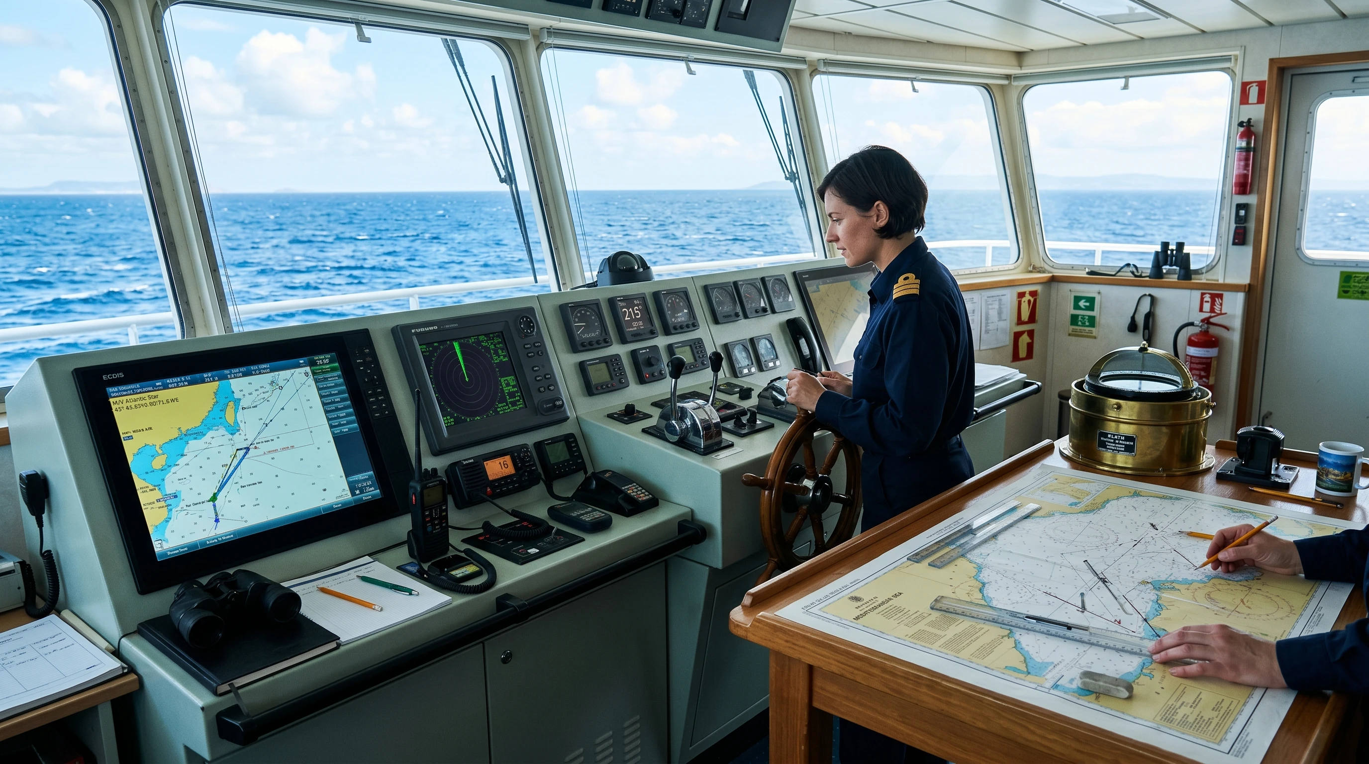
On open water, there are no road signs, lane markings, or familiar landmarks to navigate by. Vessels rely almost entirely on satellite positioning to determine their location. That includes crew transfer vessels shuttling technicians out to the farm, service operation vessels that act as floating bases, survey boats mapping the seabed, cable-laying ships, and a growing fleet of autonomous craft and drones used for inspection.
Inside a wind farm, the margins are tight. A turbine foundation, an inter-array cable, or a neighboring vessel may be only a short distance away. Many tasks demand precision measured in centimeters rather than meters. Lowering a technician onto a transition piece, holding a vessel steady against a turbine ladder in a moving sea, positioning a jack-up barge, or inspecting a buried subsea cable all depend on knowing a location with great confidence. When that figure drifts, the consequences range from wasted time and aborted transfers to genuine safety risk. Reliable positioning is not a convenience in this environment; it is the foundation on which almost every other activity is built.
What Goes Wrong Near the Towers
Satellite positioning works by measuring how long it takes signals to travel from orbiting satellites to a receiver. The receiver needs a clear, unobstructed view of as many satellites as possible, spread across different parts of the sky, to calculate a strong position. Tall turbines disrupt this in two main ways.
The first is signal blockage, sometimes called shadowing. The steel tower and the bulky nacelle at the top physically block part of the sky. A receiver sitting close to a turbine simply sees fewer satellites, and the ones it does see may be clustered together rather than spread out. Fewer satellites and poor spread both weaken the geometry of the position fix, which the receiver itself reports as a higher dilution-of-precision value. In plain terms, the receiver has less good information to work with.
The second and more troublesome problem is multipath. Satellite signals bounce off the large metal surfaces of the tower, the nacelle, and even the slowly rotating blades before reaching the receiver. These reflected signals arrive a fraction of a moment later than the signal that traveled in a straight line. The receiver cannot always tell a reflected signal apart from a direct one, so it blends the bad data into its position calculation. The rotating blades make this worse because they constantly change the reflective environment around the turbine. A receiver parked next to a turbine can show a position that quietly wanders by several meters even when the boat is not moving at all.
Why Size and Materials Make It Worse
Not every structure causes the same level of disruption, and turbine size is a major factor. A taller tower presents a larger reflective surface and blocks a bigger slice of the sky. Bigger turbines also sit on larger foundations, such as wide steel monopiles, which add even more reflective metal close to the water where vessels operate. The height matters too: reflections can come from high up the structure as well as near the base, so the interference is spread across a larger volume of space around each turbine.
The effect also compounds across a wind farm. A single turbine in isolation is one obstacle, but modern farms contain dozens or even hundreds of turbines arranged in a grid. A vessel working deep inside such an array is surrounded on every side by reflective steel structures, with no clear horizon in some directions. On top of that, the sea surface itself reflects signals, adding a background layer of multipath that is always present offshore. Tall turbines essentially amplify a problem that already exists on the water. This is the core reason GPS accuracy offshore wind turbines affect is becoming a defining design and planning challenge as projects move toward ever larger machines.
How Large Can the Error Be?
In open water, a standard satellite receiver is typically accurate to within a few meters, and with correction services, that figure can shrink to a few centimeters. Near a tall turbine, the picture changes. Horizontal errors can spike well beyond normal levels, and in the worst cases, positions can jump suddenly by tens of meters before settling again. The error is rarely constant; it tends to appear and disappear as the vessel moves relative to the tower and the blades rotate.
The most deceptive part is not the size of the error but the false confidence that can come with it. A receiver may continue to report a healthy-looking position while it is actually being misled by reflected signals. An operator glancing at a chart plotter sees a steady, believable number and has no obvious reason to distrust it. This is what makes positioning near turbines genuinely hazardous rather than merely inconvenient. It is not simply that the error is larger; it is that the error can look trustworthy. A position that is wrong but appears reliable is far more dangerous than one that is obviously missing or flagged as poor quality.
Operational Consequences
The practical impact of degraded positioning touches almost every activity inside a wind farm. Survey and inspection work suffers because seabed data, cable routes, and structural defects must be tied to accurate coordinates. If the position is wrong, the resulting map or inspection record is wrong, and a fault may later be found entirely in the wrong place.
Crew transfer and walk-to-work operations are especially sensitive. Many service vessels use dynamic positioning systems that automatically hold the vessel in place using thrusters, and these systems rely heavily on satellite data. A sudden jump in the reported position can cause the vessel to shift unexpectedly at the exact moment a technician steps onto a turbine. Construction is equally demanding, since installing foundations and turbine components requires repeatable, precise placement, often in challenging sea conditions.
Autonomous vessels and inspection drones add another dimension. These platforms are increasingly used to cut costs and reduce the need to send people offshore, and they tend to trust their positioning input completely. An autonomous craft has no human on board to notice that something looks wrong. Finally, there is the longer-term cost to asset records. If a turbine inspection, a cable fault, or a seabed feature is logged with slightly incorrect coordinates, that error becomes part of the permanent dataset and can cause confusion and wasted effort for years afterward.
Working Around the Problem
The good news is that the industry has a solid toolkit for managing positioning near turbines, and no single fix has to carry the whole load. The most effective approach combines several techniques so that the weakness of one is covered by the strength of another.
Using multiple satellite constellations is one of the simplest improvements. Rather than relying solely on the American GPS system, modern receivers also track Galileo, GLONASS, and BeiDou satellites. With more satellites in the sky, the odds of seeing enough of them through the gaps around a turbine improve considerably, and the position geometry becomes more robust.
Correction services such as real-time kinematic positioning and differential techniques can deliver centimeter-level accuracy, although they work best when the link to the correction source is itself strong and uninterrupted. Inertial navigation systems are a powerful complement here. These use motion sensors, gyroscopes, and accelerometers to track movement independently of satellites, so they can carry a vessel through short satellite dropouts and smooth out sudden jumps. Blending all of these inputs together, a process known as sensor fusion, lets a vessel lean on whichever source is most trustworthy at any given moment.
Other reference systems help too. Radar, acoustic positioning beacons on the seabed, laser scanners, and camera-based systems can all measure position relative to a turbine without relying on satellites. Receiver and antenna technology also continues to advance, with better multipath-rejection algorithms, specialized antenna designs that suppress reflected signals, and careful placement of antennas high on a vessel and away from obstructions. Finally, operational planning makes a real difference: timing approaches carefully, choosing sensible angles of approach, training crews to recognize the warning signs, and treating any satellite position near a turbine with healthy, deliberate skepticism rather than blind trust.
Looking Ahead
The trend that created this challenge shows no sign of slowing. Turbines continue to grow, with machines rated at 15 megawatts and beyond already being installed and even larger designs on the drawing board. Floating wind is also moving the industry into deeper water, and floating platforms introduce a further complication, because the structures themselves move and rotate gently on their moorings, making the reflective environment even harder to predict.
In response, positioning standards and best practices are maturing, and layered, fused positioning is steadily becoming the default rather than a premium add-on. Equipment makers are designing receivers specifically for cluttered offshore environments. The clear message is that the compromise of GPS accuracy offshore wind turbines is a manageable problem, not an insurmountable one, provided it is taken seriously from the planning stage onward rather than discovered the hard way during operations.
Conclusion
There is a quiet irony in the fact that the same towering structures that generate clean, abundant energy also create a small navigational uncertainty around themselves. For the crews, surveyors, and increasingly the autonomous systems that work among them, that uncertainty is something to respect rather than fear. The errors are real, they can be large, and they can hide behind a confident-looking number on a screen.
The path forward is not a single breakthrough but a sensible combination of awareness and technology: multiple satellite constellations, correction services, inertial and acoustic backups, smarter receivers, and well-trained crews who know when to trust the screen and when to question it. Handled this way, inaccurate positioning near tall offshore wind turbines becomes just another known hazard, planned for and managed, much like wind, tide, and weather. As offshore wind farms continue to grow in both size and number, building that awareness into every project will simply become standard practice, and the safer, more efficient the industry becomes for it.
This article was created with AI assistance and reviewed by a human editor.
About The Author


Hi Andrejs!
This is an incredibly insightful and well-written piece. The “false confidence” aspect you mentioned is what makes this truly fascinating and terrifying. Your point about autonomous vessels and drones really highlights where the industry is heading. Thanks for shedding light on a very real, quiet challenge in the renewable energy sector.
Thank you for your kind words and thoughtful comment. I’m pleased that you found the article insightful. I agree that false confidence can be one of the most challenging aspects of AI systems because errors are often harder to detect when a system appears highly reliable. That’s why continuous monitoring, validation, and human oversight remain so important, especially in critical industries.
The growing use of autonomous vessels, drones, and AI-powered monitoring tools is creating exciting opportunities for the renewable energy sector, but it also introduces new responsibilities and risks that need careful management. As these technologies become more advanced, ensuring accuracy, transparency, and safety will be just as important as improving efficiency.
Thanks again for reading and for contributing to the discussion. Your observations add valuable perspective to this important topic.