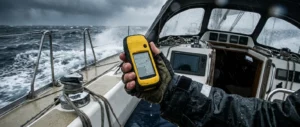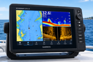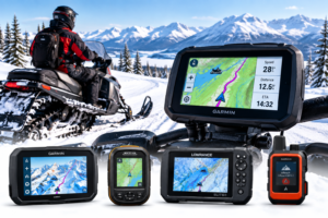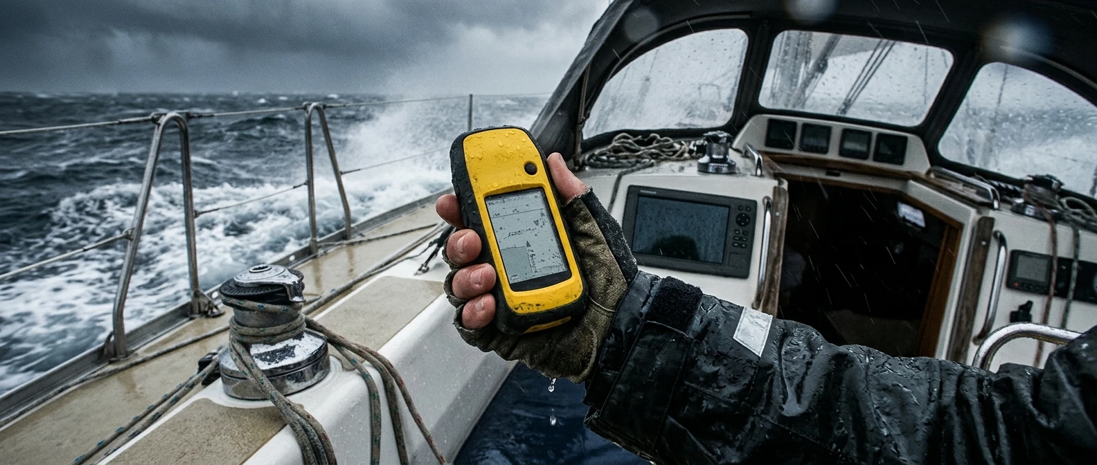
Sailors who rely on a chartplotter mounted at the helm often treat it as the single source of truth. It isn’t. A chartplotter is wired into the boat’s electrical system, dependent on an antenna that can be knocked loose by a boom or swamped by a wave, and vulnerable to the same lightning strike or battery failure that can take down every other piece of electronics on board at once. A handheld GPS for sailing is not a luxury add-on. It is the piece of equipment that keeps you oriented when the primary system stops working at the worst possible moment.
This article looks at why that failure mode matters more at sea than almost anywhere else, what separates a genuinely rugged handheld from one that only looks tough in a catalog photo, and how to keep a backup unit ready for the day you actually need it.
Why primary GPS is not enough in extreme conditions
A fixed-mount chartplotter is built for convenience, not survival. It usually draws power from the house battery bank through a run of wiring that passes near bilges, engine compartments, and other places where saltwater intrusion and corrosion do their quiet work over seasons. When that wiring fails, or the battery bank is damaged in a knockdown, the chartplotter goes dark along with the autopilot and the VHF.
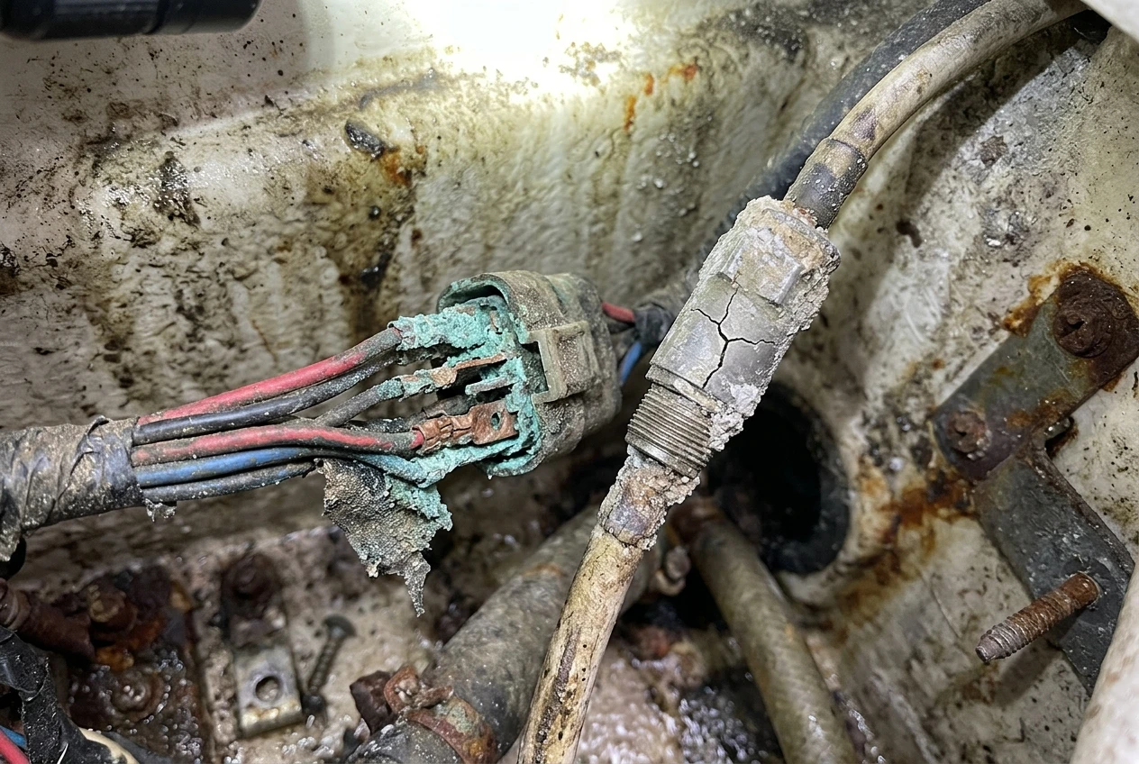
Extreme weather multiplies the ways a primary system can fail. A boat taking green water over the deck can short an exposed antenna connection. A lightning strike, even a near miss, can fry the sensitive electronics in a plotter without leaving a mark on the hull. A dismasting can take the GPS antenna with it if it was mounted at the masthead. None of these are rare, theoretical scenarios for anyone who has spent real time offshore; they are the specific conditions under which backup navigation gets used.
A handheld unit sidesteps all of this because it runs on its own battery and carries its own antenna. It does not care whether the boat’s twelve-volt system is working. It does not require a wiring harness, a fuse panel, or a dry-mounting bracket. That independence is the entire point of carrying one, and it is why the checklist in The Safety Equipment Every Boat Needs Before It Leaves the Dock treats a backup GPS as standard equipment rather than an optional extra.
It is worth being precise about what a handheld GPS is for. It is not meant to replace the primary chartplotter day-to-day, and it is not a substitute for paper charts and a compass, which have their own place in a layered navigation plan as covered in The Role Of Compass And Charts In Modern Marine Navigation. A handheld’s job is narrower and more specific: get a position fix and hold a course when nothing else on the boat can.
Criteria for choosing a rugged emergency GPS
Not every handheld GPS sold for hiking or general outdoor use belongs on a boat. The marine environment is harder on electronics than almost any other setting a consumer device is designed for, and the criteria for an emergency unit need to reflect that.
Waterproofing rating. Look for a unit rated to withstand full submersion, not just splashes. An IPX7 rating means the device can survive brief submersion in up to a meter of water; some marine-specific units go further. A device that only resists spray is a liability on a boat that takes water over the rail in anything above a moderate chop.
Buoyancy. A handheld GPS that sinks is one you will lose the moment it goes overboard, which, on a pitching deck in bad weather, is exactly when it is most likely to slip from a wet hand. Units built to float, or ones you pair with a floating lanyard or case, solve a problem that waterproofing alone does not.
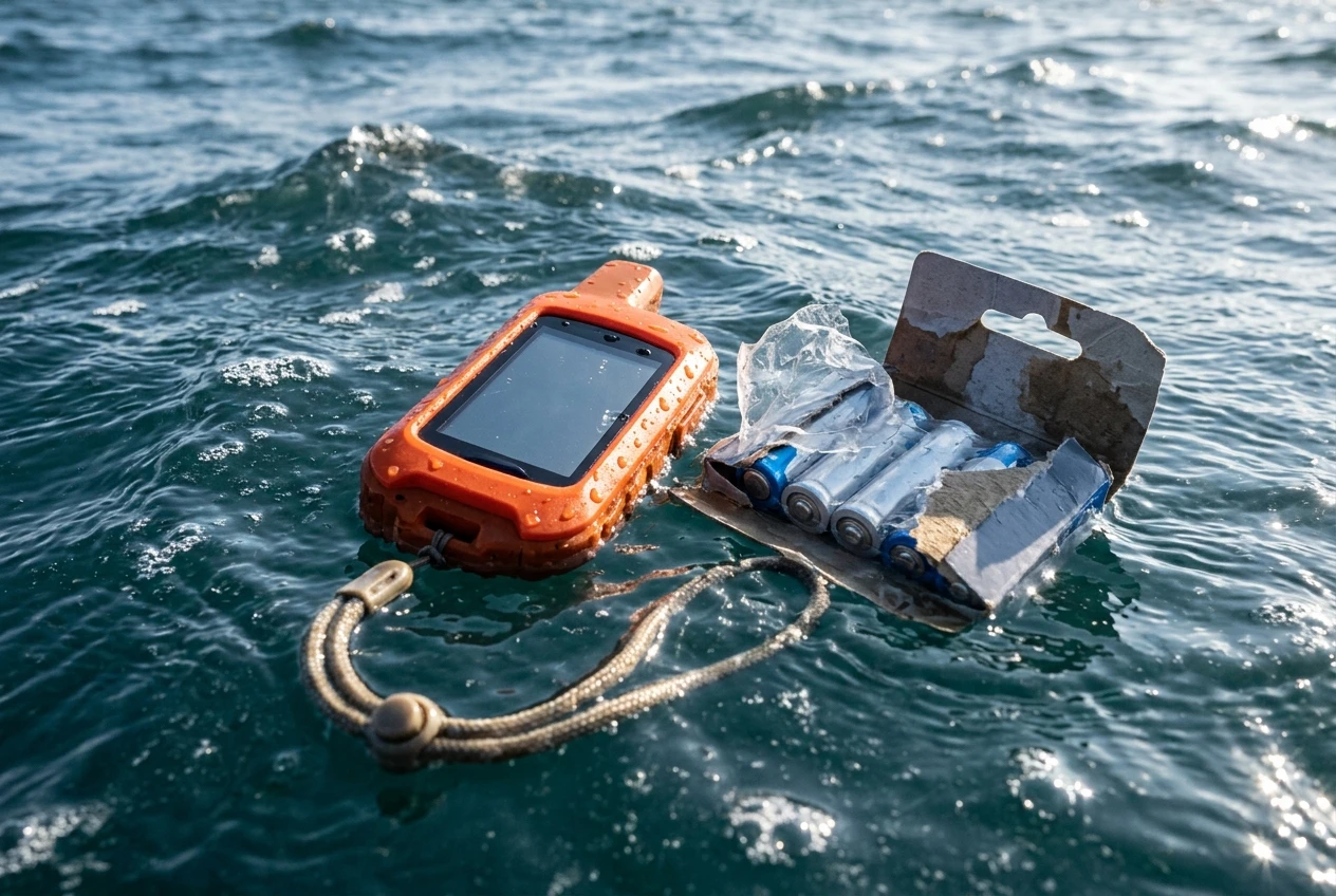
Battery life and power source. An emergency device needs to run for days, not hours, on a charge or a set of batteries. Units that take standard AA batteries have an advantage here: you can carry spares in a dry bag and swap them without a charging cable or power source, which matters if the boat’s electrical system is what failed in the first place.
Satellite reception in poor conditions. A unit’s ability to hold a fix depends partly on which satellite constellations it can access. A handheld that reads only the US GPS constellation is more exposed to signal gaps than one that also reads GLONASS, Galileo, or BeiDou, particularly at higher latitudes or when cloud cover and sea state degrade reception. The differences between these systems and what they mean for accuracy and reliability are covered in more depth in Comparing GPS Vs GLONASS, BeiDou And Galileo In Marine Navigation, and it is worth understanding before you choose a unit.
Screen visibility. A screen that washes out in direct sun or is unreadable when operated with wet, salt-crusted fingers is a screen that will cost you time in an emergency. Transflective displays, which use ambient light rather than fighting it, tend to hold up better on open water than backlit screens built mainly for indoor or low-light use.
Physical controls. Touchscreens that require a dry, bare fingertip are a poor fit for a boat where hands are wet, gloved, or shaking from cold. Physical buttons that can be operated by feel, without looking, are a meaningful advantage when conditions are rough enough to require the GPS in the first place.
Simplicity of operation. An emergency device is not the place for a steep learning curve. You want a unit where getting a position fix and a bearing is a short, memorized sequence of button presses, not a menu structure you have to relearn under stress.
Satellite messaging capability. Some handheld units pair GPS positioning with two-way satellite messaging, letting you send a distress alert or a short message even where there is no cellular signal. This is a genuinely different capability from position-finding alone, and for offshore sailors it can matter as much as the GPS function itself.
Top-rated handheld models for marine environments
A handful of handheld GPS lines have built a track record specifically in marine use, distinct from units designed primarily for hiking or land navigation. The following are worth researching further against the criteria above before you buy.
Garmin GPSMAP handheld series. Garmin’s GPSMAP handhelds are built around a dedicated GPS chip with multi-constellation support, a transflective display designed for outdoor visibility, and a housing rated for water resistance well beyond splash-proofing. They run on AA batteries or a rechargeable pack, depending on the model, giving you the option to carry spares rather than rely on a charger. Physical buttons rather than a touchscreen-only interface make them usable with wet or gloved hands.
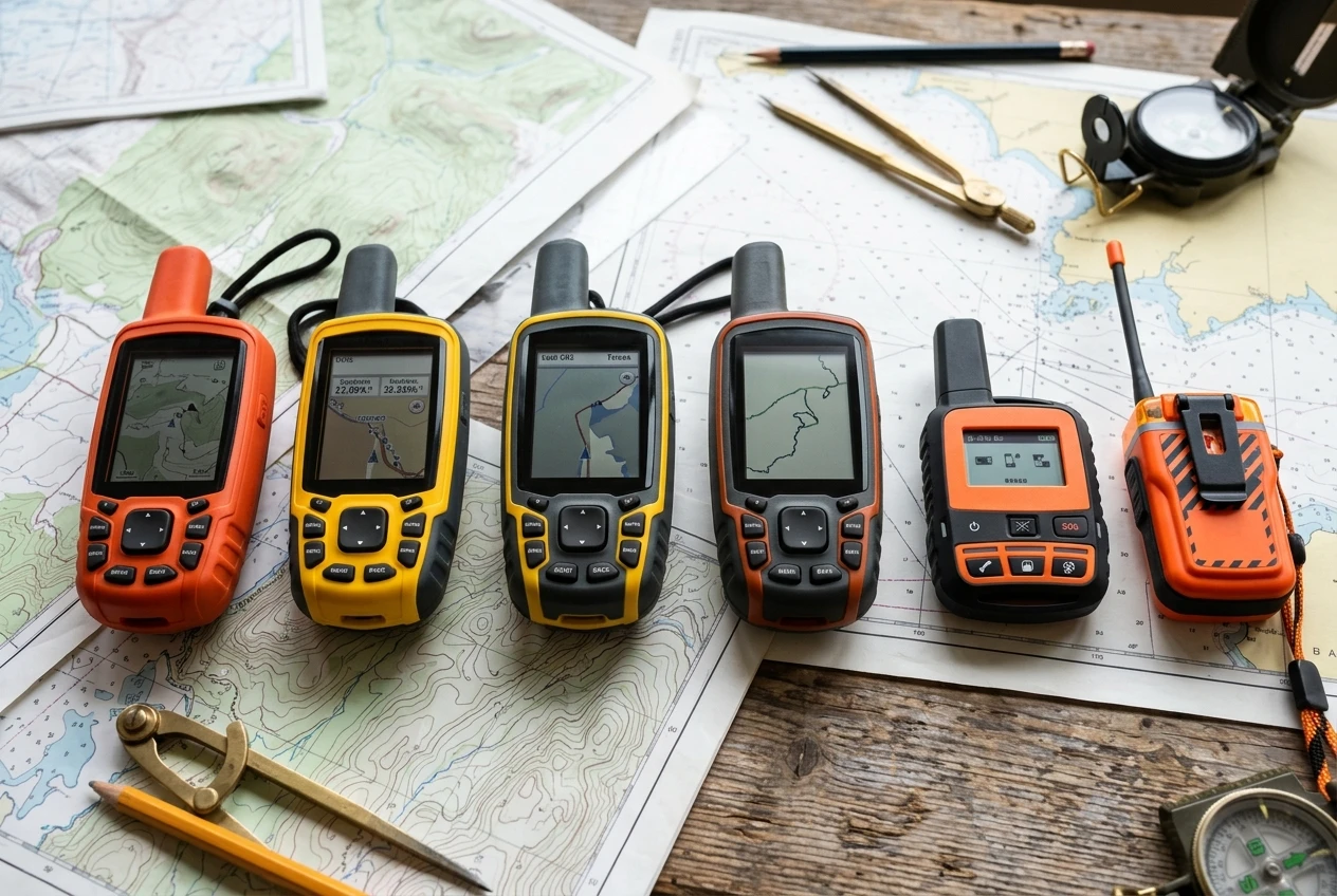
Garmin inReach series. The inReach line adds two-way satellite messaging to GPS positioning, allowing it to send an SOS and relay your location to a monitoring center even in the open ocean, far outside cellular range. This is a different category of device from a position-only handheld, and for anyone sailing well offshore it is worth weighing the satellite messaging subscription against the added safety margin it provides.
ACR ResQLink and similar personal locator beacons. These are not GPS navigation devices in the conventional sense; they are distress beacons that, once activated, transmit a GPS-derived position to search-and-rescue satellites. They belong in the same conversation because they serve the same underlying purpose as a backup handheld GPS: providing a reliable position when the boat’s primary systems have failed. Many sailors carry one of these alongside, rather than instead of, a handheld GPS unit.
Other rugged outdoor handhelds. Several manufacturers outside the marine-specific space build rugged, waterproof handheld GPS units aimed at hikers and off-road use. Some of these hold up well in a marine environment, but check the waterproof rating and buoyancy specifically before trusting one at sea; a unit rated for rain and puddle crossings is not the same as one rated for being dropped into saltwater.
Whichever unit you’re considering, verify the current waterproof rating, battery type, and satellite constellation support directly from the manufacturer before buying, since these details change between model generations. The general categories above are a starting point for research, not a substitute for checking the specifics of the exact model you’re looking at.
How to maintain your emergency GPS battery life
A backup GPS that has lost its charge or whose batteries have corroded in storage is no backup at all. A handheld’s reliability depends almost entirely on whether it has been maintained between the rare occasions when it is actually used.
Store it with fresh batteries, not old ones left over from the last trip. Batteries left in a device for months can leak and corrode the contacts, which can disable the unit entirely even if the batteries themselves still hold some charge. Replace batteries on a fixed schedule, such as at the start of each season, rather than waiting until you notice a problem.
Use lithium batteries for cold-weather or long-term storage. Lithium AA batteries hold their charge longer in storage than standard alkaline batteries and perform better in cold conditions, which matters both for how long the device will last unused in a dry bag and how it performs if you need it during a winter passage.
Power the unit on periodically, even when it is not in active use. A GPS unit that has sat untouched for a year may need time to reacquire satellites, update its almanac data, and confirm its firmware is functioning, none of which you want to discover for the first time during an actual emergency. Turning it on every few weeks, letting it get a fix, and checking the battery level takes a few minutes and tells you whether the unit is actually ready.
Keep a charging cable or spare battery set in the same dry bag as the device. A fully charged handheld with no way to recharge it, or no spare batteries, is only good for as long as its current charge lasts. Pack the unit, its cable or batteries, and any mounting accessories together so nothing is scattered through the boat when you need to grab it quickly.
Update firmware and map data when the opportunity allows. This usually requires connecting the device to a computer or app while in port, so it is easy to let slide. Outdated firmware can affect satellite acquisition time and battery management, so treat an update check as part of your pre-departure routine alongside the rest of your safety gear inspection.
Avoid leaving the unit in direct sun or extreme heat when stored aboard. Lockers near engine compartments or under deck hatches in direct sun can reach temperatures that degrade battery chemistry faster than normal use would. A cooler, shaded storage spot extends both the battery’s working life and its shelf life between uses.
Where to store your backup device
The best handheld GPS in the world is useless if it’s stowed somewhere you can’t reach it when the boat is being knocked around in heavy weather, or worse, if it goes down with the boat because it was never meant to come with you.
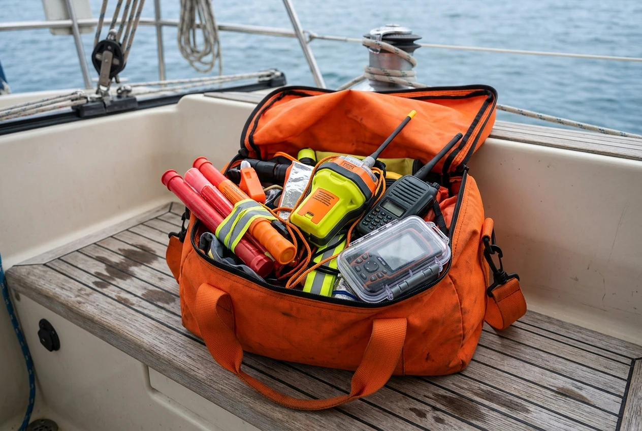
Keep it in your abandon-ship bag, not a drawer below. If you ever have to leave the boat, grab the handheld GPS in the same motion as your flares, EPIRB, and emergency radio. A device stored in a cabin locker does you no good if the boat is taking on water and you don’t have time to go looking for it.
Use a floating, waterproof case or pouch even if the unit itself is rated waterproof. Manufacturer waterproof ratings describe controlled conditions, not the reality of a device being dropped into a cockpit full of water during a storm. A dedicated floating case adds a layer of protection and makes the unit easier to spot if it ends up in the water.
Choose a location that’s accessible without going below in rough conditions. A cockpit locker or a dedicated pouch near the companionway is generally more practical than a cabin stored toward the bow, where motion is worse, and access is harder when the boat is heeled over or pitching.
Keep it separate from, not instead of, your primary chartplotter and your paper charts. A layered approach to navigation, where the handheld GPS is one of several independent systems rather than the sole backup, gives you more margin for error when things go wrong. The differences between older and newer navigation approaches, and why redundancy across methods matters, are covered in Differences Between Traditional And Modern Navigation Methods For Sailboats.
Tell everyone aboard where it is. A backup device whose location only one person on the boat knows is a single point of failure in itself. Make sure the location is part of your boat’s safety briefing, not a detail known only to the skipper.
A handheld GPS for sailing earns its place on board by being ready on the one day everything else fails, which means the device, its battery, and its storage spot all need attention well before that day arrives. Treat it as part of your standard safety equipment rotation, check it on a schedule, and keep it where you can reach it without thinking.
Read the full reviews of our top-rated handheld GPS units.
This article was created with AI assistance and reviewed by a human editor.
Disclosure: This post contains Amazon affiliate links. If you buy through them, we may earn a small commission at no extra cost to you.
About The Author