Before commencing Marine Navigation Software review topic, I would like to start with a small introduction.
I want to start a topic on maritime navigation software. Why? Although I am a sympathizer of standalone marine GPS hardware, at the same time using a broad range of mobile devices and laptops. Untouching, the sea navigation mapping, and computerization of nautical charts would be unfair. Various brand marine cartography electronic products have become very popular and in demand.
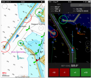 I once again want to remind the fact that any smartphone, tablet or even laptop use for safe navigation would not be viewed as the primary navigation tool. No matter how cool a navigation chartploting app to be.
The market is saturated with a navigation program and app intended for the use of water transport. Almost everyone today has a smartphone, tablet or laptop. Most of them are equipped with GPS receivers.
So any smartphone, tablet or laptop could be used as a GPS navigation device, or even chartploter when a relevant marine navigation Software is installed.
As my personal experience, I can say that sooner or later the iPhone will become unusable if it will be used as only a navigation tool on the waters. When the tablet or phone is used on open decks, and salty spray on it is only a matter of time.
I had such a case with the iPhone 4. Water ingress was not included in the warranty situation and repair cost of around € 130. Now, being on the water, I always use an airtight plastic bag which is not handy for any app control and smartphone become useless for navigation tasks, except phone calls.
So back to the marine navigation software. I would say that I have not tried all of them, but I’m a professional marine navigation officer with rather a lot of experience. I think I can somewhat objectively judge of this kind of software. I also have a lot of experience with both the oceangoing sailboats and other pleasure yachts, sailing large distances over tricky sea routes.
I have to admit that the line between professional IMO adopted maritime navigation programs (ECDIS) or electronic mapping software, as they are often called, and nautical mapping software, found in Appstore or GooglePlay, is not so thick.
Professional sailors can oppose me and many, in theoretically, they would also be true. But, I am also a professional and am sure that the majority of the market accessible marine navigation software are good enough for safe navigation.
There is the most popular marine navigation software available on the market today. Navionics HD, iSailor, Imray iPad app, Plan2Nav, Garmin, iNavx, Memory Map, MaxSea, Nobeltec TimeZero and more.
I am not going to analyze in detail all of these programs, but reviews will try to build as if the same would like to purchase for the next sea adventure.
In reality, why probabilistic form?Most recently, a fellow skipper asked me whether I could help him with navigation of the great Dutch sailing ship from the Mediterranean to Baltic sea.
So, why not to make a proper research and be ready for safe sailing with excellent marine navigation software installed on my MacBook Pro and iPhone 6S Plus.
No matter what onboard navigation equipment I would meet, next voyage route plans and much other for safe navigation information already be ready for a sea adventure. I can make simulation route from Mediterranean waters to Baltic Sea using chosen marine navigation software, and pre enjoys this great voyage.
