Review of “E-Navigation: The Ultimate Digital Co-Pilot for Sea and Road” by Ken Collier (1 August 2025)
Ken Collier’s article, “E-Navigation: The Ultimate Digital Co-Pilot for Sea and Road,” is a thoughtful and timely exploration of how digital navigation tools are reshaping the way we move—both on the water and on the road. With a clear and engaging writing style, Collier deftly weaves together technological insight, local context, and broader cultural commentary.

Strengths
1. Localized and Practical Insight:
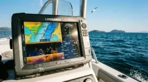
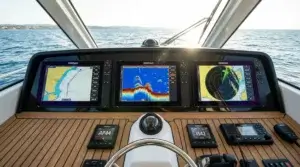
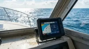
By focusing on the Arcachon Basin and the SIBA-developed E-navigation app, the article grounds technological innovation in a specific, relatable context. The explanation of the app’s integration of bathymetric data, real-time geolocation, weather updates, and regulatory alerts paints a convincing picture of a modern mariner’s indispensable companion.
2. Balanced Perspective:
Rather than falling into tech evangelism, Collier examines both the benefits and potential pitfalls of our growing dependence on GPS tools. The juxtaposition of sea navigation and land-based driving—especially during France’s infamous “black day” of summer traffic—effectively illustrates a universal trend: digital convenience is increasingly replacing traditional skills.
3. Human Element:
The inclusion of Adrien’s anecdote adds emotional resonance and generational perspective. His nostalgic view of old road maps and his current reliance on GPS reflect a broader societal shift toward digital autopilot—making the article not just informative, but reflective.
Minor Critique
The article might have benefited from a deeper dive into how E-navigation compares with other international maritime navigation tools or emerging alternatives. A brief nod to cybersecurity or data privacy concerns could have added an extra layer of critical analysis.
Conclusion
Overall, “E-Navigation: The Ultimate Digital Co-Pilot for Sea and Road” is a well-rounded, insightful article that goes beyond technical features to explore the psychological and societal implications of modern navigation. It encourages readers to embrace innovation without abandoning awareness, offering a valuable reminder: technology should enhance, not replace, our connection to the world around us.
Rating: ★★★★☆ (4.5/5)
Recommended for: Tech enthusiasts, sailors, summer travelers, and anyone interested in how digital tools are transforming our sense of direction—literally and metaphorically.
———————————————————————————————————————————————————————-
L3Harris Selected by U.S. Space Force to Develop GPS Satellite Designs
L3Harris Technologies has been awarded a contract by the U.S. Space Force’s Space Systems Command to create design concepts for Phase 0 of the Resilient Global Positioning System (R-GPS) program.
The R-GPS initiative aims to strengthen the current GPS constellation by incorporating cost-effective small satellites, enhancing resilience for both military and civilian users. As part of the program, up to eight additional satellites will be added to the existing 31-satellite GPS network. These new satellites are engineered to address threats such as jamming and spoofing, ensuring uninterrupted positioning, navigation, and timing (PNT) services.
With extensive experience in GPS technology, L3Harris has contributed to every U.S. GPS satellite launched to date, as well as to the development of control systems, monitoring receivers, and user equipment. This expertise underpins their proposed solution for the R-GPS program.
According to L3Harris, the company is leveraging its investments in advanced PNT technologies to meet the evolving needs of the Space Force. By employing commercial form factors and modular interfaces, they aim to deliver a scalable and adaptable solution. Additionally, L3Harris is collaborating with the Space Force as the prime contractor for the experimental Navigation Technology Satellite-3 program, which focuses on pioneering innovations and accelerating satellite development timelines.
China BeiDou Satellite Navigation System will hardly satisfy all the Chinese.
China is spending billions for their own sat nav system. By me, then it is just great, and the Chinese government wanted to be independent of US GPS as well as Russian GLONASS or European GALILEO. Chine is producing many local satellite positioning gadgets like Huawei, Xiaomi, OnePlus, Meizhu, HTC, and Nubia. Some of them is well known some not.
I guess that many China people use them but what about the iPhone or even Samsung? Almost any other brand smartphones are equipped with GPS and GLONASS chips so BeiDou is useless for other just China brand phones. I hardly believe that Apple ever equips its smartphones with BeiDou satellite receiver chips even though my new iPhone X has been assembled in China.
————————————————————————————————————————–
What is the Best Handheld GPS?
Maybe for this topic is not the right place on the News page, but let it stay here.
I just want to show you screenshot on my Amazon associates report for the last quarter of the year 2017. It is real data and taking into account that none of these GPS devices are no on the first rows in Google for name keywords on my website, I guess that people know the value of purchased handheld GPS. You can see that the most popular is Garmin Montana 680t, Garmin eTrex 10 and 30x as well as Garmin Montana 610.

Surprisingly for me is that a fairly expensive Magellan eXplorist TRX7 Off-Road GPS Navigator is located between well-purchased devices, just it is not a handheld device.
None of them is amongst returned items.
After some researches, I found that traffic comes from posts about GPS for ATV and GPS for Snowmobiles. I do not believe that someone spent $400 to $600 not knowing what he buys.
It is the best indicator of the quality of handheld GPS, mostly for adventures in relatively difficult off-road conditions.
GPS Forties Anniversary
Back on 19 July 1977 Rockwell Collins engineer David Van Dusseldorp sat on the roof of one of the com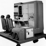 pany’s building adjusting an antenna every five minutes to try to receive a GPS signal from the NTS-2 satellite.
Guys and gals in the room below the roof decoded the signal, an era of Global Positioning System was begun.
That first GPS receiver was six feet in height and had two seats where engineers sat monitoring and adjusting its signal input.
Today GPS receiver fits in the wrist watches and even smaller size GPS trackers.
__________________________________________________________________________________________
Iran is about to Launch Local Sat Nav System
As I have stated many times that GPS stands for Global Positioning System is not the only sat nav constellation on the  Earth. Russians have GLONASS, Europe is about to complete their long-term project GALILEO but China and India can proudly announce about local navigation systems similar to GPS.
Now is time for newcomers as Iran has announced to build its own satellite navigation system. It’s not just empty speeches, as Iran has already had two communication satellites since 2005. So the country has enough scientific and financial sources to implement new local sat nav system.
_____________________________________________________________________________________________
GPS Market Estimates for 2017
 I was a little surprised seeing that according to the Manufacturers Analysis and Top Sellers of Global Gps Navigation Systems on the top position is Bushnell followed by Garmin, Magellan, Rand McNally and in the fifth position one of my favorite brand TomTom.
Need to take a closer look what Bushnell offer on the GPS market except for GPS golf watches and GPS range finders.
_________________________________________________________________________________________
Garmin eLog for truck drivers
„Garmin International Inc., a unit of Garmin Ltd. (NASDAQ: GRMN), today announced the Garmin eLog Compliant ELD – a sleek, easy-to-use, hours-of-service (HOS) electronic logging device (ELD) designed to be used by drivers 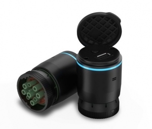 who are currently required to prepare HOS records of duty status (RODS) in compliance with recent amendments to the Federal Motor Carrier Safety Administration (FMCSA) ELD mandate. The Garmin eLog is easy to install and setup and comes with the benefit of having no subscription fees. The versatile device is equipped with an adaptor that supports 9-pin J1939 and 6-pin J1708 diagnostic ports to fit nearly any truck. Truckers can easily download the free Garmin eLog™ App to a compatible smartphone1 to complete their ELD compliance solution. Once downloaded, RODS are securely stored in the driver’s smartphone with the option to share Garmin eLog data for inspection purposes.“
Read entire post here
_____________________________________________________________________________________________
InSight Mobile Data partners with Sygic Navigation.
InSight Mobile Data, Inc. begun partnership with SYGIC. The main goal is to integrate 3D GPS navigation for heavy vehicles into the 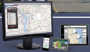 It promised to be one of the most comprehensive mobile platforms on the market with truck routes globally.
InSight Mobile Data develops innovative, flexible fleet management and asset solutions that provide real-time visibility into the mobile work environment.
____________________________________________________________________________________________
Check a Waze to Find a Cheap Ride to your Office.
I recently came across an inc.com post about Google-owned Waze traffic navigation GPS app. Besides fast food ordering option Waze also offers the carpooling feature. It means that for a small fee which cover gas and car maintenance expenses a driver can pick up passengers heading the same direction. It is currently available just in some US places like California, Sacramento, San Francisco Bay, and Israel.
Unlike Uber, Waze isn’t trying to make money for itself or the drivers offering to share a ride. By me, it is a great idea just how it can be integrated and how legal it is? It could be one of the ways to solve congestion in big cities.
_____________________________________________________________________________________________
Navigation with Indian Constellation (NavIC)
NavIC is earlier known as the Indian Regional Navigation Satellite System (IRNSS).Just my two cents regarding Indian 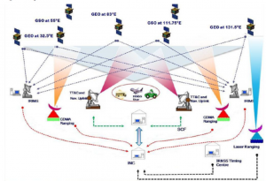 India’s efforts to build their satellite navigation systems.The idea and goals are great just how much does it cost? India is developing but in the same time looking but at the same time seeing the poverty and the big difference between rich and poor, the question arises whether it would be more appropriate to use these funds for raising the level of life.
Disclaimer of independence from the US GPS system is a ridiculous argument. Also, European Galileo project has cost EU taxpayers large amounts of money but the real result so far absent.
____________________________________________________________________________________________
Internet of Things and GPS tracker
Sigfox announced that expands its service net within the USA. As the provider of connectivity for the Internet of Things (IoT) Sigfox is about to cover twenty percent of the U.S. population and spread network in more than 100 cities as Los Angeles, New York, Chicago, Atlanta and San Francisco.
One of the gems of Sigfox and LoRaWAN networks is low power and small subscription fees HidnSeek GPS tracker. Take a look.
——————————————————————————————————————————————————
GPS navigation is a great help but be careful when you get stuck in heavy snow conditions.
Do not blindly trust alternative routes offered by GPS navigator especially if it offers shortest forest path. In  snowstorm better stay on the main highway. It is a better chance for help than being trapped on the narrow track in wood or between mountain rocks.
„Pennsylvania family wanting to see Grand Canyon National Park’s North Rim got stranded following forest roads suggested as an alternate route to State Route 67, which closes for the winter along with park facilities. A woman suffered frostbite walking 26 miles trying to get help, while her husband eventually was able to call rescuers by climbing high enough to get a cellphone signal.“
Safety TIPS
GALILEO is Live
GALILEO, the European global navigation satellite system goes live. The Galileo Initial Services Declaration has been issued on December 15, 2016. Long and the rough way which begins back in 2005. Europe wants to be independent in satellite navigation like India with IRNSS and China BeiDou. Until the end of 2020, totally 24+6 satellites constellation is promised to be fully functional and ready for service.
In fact, who cares how many units is added to such crowded space, for other people and me the only interest is What are the benefit for me and others who are using so popular GPS receiver chip’s equipped devices. Almost every smartphone can be used as a satellite navigation device, and most of them can receive signals from GPS and GLONASS (Russian satnav). What about GALILEO?
As far as I could find
„The BCM4774 Sensor Hub chip integrates a GNSS Receiver with a function of hub of sensors of second generation on a single chip. It supports at the same time Galileo, GPS receivers, GLONASS, SBAS, QZSS, and Beidou […]
– Support of the European Galileo satellite system combined with the simultaneous support of six different satellite systems.“
I am not sure about iPhone users as A10 processor included its hub of sensors (Sensor Hub), so if the BCM47734 also have a hub of sensors, It can be assumed that it is not used in the iPhone 7.
My understanding is that none of Apple gadgets are ready for GALILEO signals. Maybe iPhone 7S or iPad Pro2 will?
————————————————————————————————————————————————————
Next Generation Navigation Without GPS, Too Far from Reality.
It’s great that people are searching for another navigation method other than satellite navigation as GPS, GLONASS, Galileo, and BeiDou. No matter how convenient and familiar we are with GPS; there are some significant drawbacks which are few who knows.
One of it is well-known satellite signal loss in tunnels, underwater and sometimes in city jungles between high buildings or in canyons. Another is intentional and unintentional GPS signal jamming and interference. And finally weak various data protection.
In the University of California has been developed navigation system which solely is based on existing signals as WI-FI and cellular. This technology mainly is intended for the use of fully autonomous vehicles as drones, ships or unmanned cars.
This system is promised to be tamper-proof and high accuracy.
My conclusion that it is an excellent idea and definitely could work if only these, at least two networks are available and constant. GSM or other cellular coverage is more or less stable but when it comes to WI-FI then the long way still to be perfect. Although in some local area just to proof that the system works, it is feasible.
_____________________________________________________________________________________________
Do not Type Msg, Navigate GPS and even Talk by Cellphone When Driving Rhode Island.
„The Rhode Island Traffic Tribunal has ruled that using a cell phone’s GPS function while driving is against the law.“
According to the same state law, a “global navigation satellite receiver” that only works as a GPS navigation device is exempted from the statute.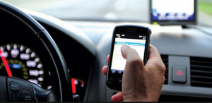
Where is logic? So, it means that no way, even voice guided Waze App is against the law? Actually, I am not a big fan of any cell phone navigation applications, but such a law is even more stupid as many European Union directives.
I do not see any difference in operation manner between stand-alone Garmin GPS device and Garmin Navigation App for iPhone when it comes to navigation.
_____________________________________________________________________________________________
BREXIT impact makes Britain think about the GALILEO future.
GALILEO Sat Nav system is about to completion stage, and just eight satellites remain to complete the constellation. Many British companies are involved in GALILEO program. BREXIT makes many to feel uncomfortable as the project 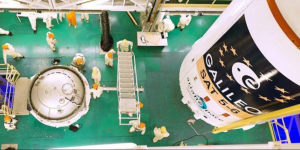 is EU countries privilege and access. Some European companies already shortened their investments to the GB based aerospace industry.
BREXIT makes many to feel uncomfortable as the project is generally EU countries privilege and access. Some European companies already shortened their investments to GB based aerospace industry.
______________________________________________________________________________________________
Does Android 6.0 Marshmallow phone would find your location even in deep caves?
I don’t know it to consider as NEWS or another Android glitch?
Anyway, to improve GPS accuracy or in some cases to be able to use GPS on your Android device at all for Android Marshmallow 6.0 running devices the „Bluetooth scanning” must be activated.
What is it?
Theoretically, your device’s Bluetooth is scanning BT enabled devices around you, and you can get position even if your unit has no GPS signal. But those other devices not always standing still and it could not be just simple triangulation. Maybe your phone is stealing GPS from surrounding ones? I could not find Google’s explanation, but it works just be ready that battery drains out much quicker.
My present iPhone 6S and previous iOS phones have lost location ability in very few situations except in undergrounds or on lower decks of large ferries. I suppose that none of the phones can find a GPS signal in these conditions.
So, how Android Marshmallow units doing it, if really?
_____________________________________________________________________________________________
Next Two Satellites Have Joined to GALILEO Constellation.
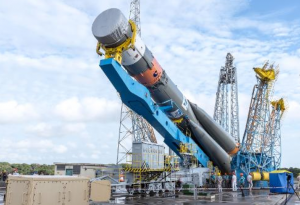
A couple of days ago Soyuz rocket from French Guiana delivered on the orbit two more satellites for European sat nav system GALILEO. So, for now, EU satellite navigation constellation consists of fourteen from totally 30 intended.
I am European citizen and have to be a patriot but, honestly, I cannot find real advantages to spending so many €€ just to compete with American GPS. Time will show, but somehow it takes even my tax money too. As everyday sat nav user, GPS is OK for me. Let see in a couple of years.
____________________________________________________________________________________________
Use of VLF signals to backup GPS.
Development of VLF (very low frequency) radio signal system is one of the real backup solutions in case of no GPS signals available.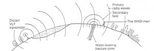
It is nothing new, and VLF is used to communicate with submarines. There are fixed base stations, and triangulation of signals gives your position, very much like GPS positioning.
A big advantage of those signals is its ability to be received in such places as tunnels or other skies covered environments where any sat nav signals cannot be acquired.
The main goal is to make a ready to plug in existing sat nav device so it means that you will never get lost even in city skyscrapers jungles or in the deep mountain caves.
____________________________________________________________________________________________
India demands the Panic Button for cell phones.
The Very smart decision made Indian government regarding security and safety net. A panic button is mandatory for all mobile phones to be sold in India from January 1, 2017. It is to enable users to make emergency calls efficiently.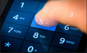
Beginning January 1, 2018, all mobile phones must be equipped with GPS or local Indian satellite navigation system ISN receivers.
By merely pressing numeric key „5“ or „9“, an Emergency signal is activated. India demands the Panic Button for cell phones.
__________________________________________________________________________________________
GPS without GPS, Is It Real?
GPS for cars and ships, GPS for kids and pet tracking, GPS for missiles and more. It is evident that sooner or later our car or jumbo jet flying high over our heads could lose GPS signal. Many reasons why. Recent reality when North Korea was jamming GPS signal is living proof.
What is the solution?
US military scientists are developing an alternative positioning system which will not depend on GPS.
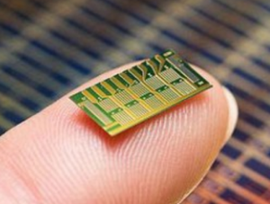 DARPA (Defense Advanced Research Projects Agency) to begin looking at miniature inertial sensor technology as a way to provide “self-contained” inertial navigation for precise guidance in the absence of GPS.
In other words, it is the chip has a six-axis inertial measurement unit made of three gyroscopes and three accelerometers, along with a master clock.
It sounds very futuristic, but it is the reality. A cost of one manually assembled chip could reach up to one million dollars. Costly isn’t it.
__________________________________________________________________________________________
One more proof that GPS navigation system can be easily affected.
April 2, 2016
Here is the real proof of what I wrote above. That is that you can not just rely on GPS. North Korea has jammed GPS signals near the South Korean border by using radio waves.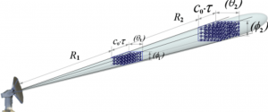
A signal disruption affected more than one hundred vehicles including planes and ships as well as cause mobile phone malfunction.
It is not the first GPS signal disruption attempt. Since 2010, it is the third time, and North Korean is believed to be using equipment imported from Russia.
South Korean fishing vessels were the most victims of this action. Luckily traditional navigation skills still have not lost. Radar on, paper navigation map on the table and way to home port is found.
It is just another reminder to refresh your professional navigation skills and for car drivers to keep paper road maps in a glove box.
__________________________________________________________________________________________
Navionics Updates and Renewals Half Price Down!
March 9, 2016
Navionics on X-Traverse is now providing iPad, iPhone, and iPod Touch users chart renewals at 50% off the current price. By using Fugawi Marine 5 or a chartplotter? You can upgrade to a Navionics+ microSD or CF card for half-price!
What does this mean for X-Traverse users?
Any X-Traverse user who has EVER purchased a Navionics chart product for iNavX, MacENC, or Fugawi Marine 5 via X‑Traverse can renew their expired chart subscriptions for 50% off the current purchase price, regardless of how long ago the chart expired. As always, a valid chart subscription gives you unlimited updates to the most current and freshest data for one year.
______________________________________________________________
TomTom Map Updates Over The Air.
TomTom is about to delivery car GPS navigation map updates in a new, more efficient way. It is Real-Time Maps. Instead of TomTom NavKit, a Navigation Data Standard (NDS) 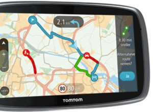 maps will be used.
Car makers have more flexibility in choosing map suppliers. Driver’s GPS navigation device maps will constantly be updated over the air.
__________________________________
Will IRNSS be able to compete with the GPS?
India is in the final phase to complete its satellite navigation system called Indian Regional Navigation Satellite System (IRNSS).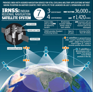
The final space vehicle launching is planned in July this year. India claims that it’s new local sat nav system will be more accurate than GPS, and a country will have independence from the US and other satellite navigation systems.
IRNSS constellation includes seven satellites, where four is geostationary but three moving. When it comes to accuracy, then I am in doubt it will be more than GPS. For me, it looks like a little Ostentation.
We’ll see in next years.
_________________________________________________________
The Final Satellite of GPS 2 Era Reaches its Spot in Constellation.
Last GPS 2 satellite has been launched on 7th of February 2016. No, no, it does not mean the end of GPS development. Next year the GPS 3 programs first satellites are supposed to be delivered in the skies.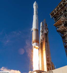
The first GPS 2 family satellite was born about 27 years ago. No words to say of enormous significance of the Global Positioning System to any spheres of modern life. Just to say that estimated that 4 billion GPS enabled devices worldwide and expected this amount to double in next 5 to six years.
Last 2F GPS 2 satellite complete improvement of accuracy and now it could be considered as 42 cm instead of 90 cm before.
Just two words how we can find our position by GPS. Satellites emit signals, and user’s devices calculate time delay for the signal to reach the receiver. So a distance to satellite has been calculated and to get our latitude, longitude, and altitude measurements for at least four different satellite simultaneously have to be calculated and resulted. In addition to three-dimensional position, we get our velocity and time.
______________________________________________________________
GPS signal loss can occur unexpectedly
As I mentioned before, a GPS signal could be lost due to intended or unintended reasons. It is a very uncommon situation but happens. Last year some US vessels lost GPS signal when transiting non-US waters. Ships lost any GPS signal which severely affected ECDIS, radar and any other navigation equipment, which properly could not be operated losing GPS connection.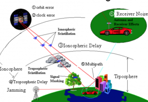
After about six n.m. all GPS units resume operations, and all equipment continue to fulfill their tasks. Happily, shipmasters and navigation officers had not had not yet forgotten the traditional navigation tools, and the ability to navigate ships using navigational landmarks.
The U.S. Coast Guard issued a safety alert that underscores the need to be aware of the possibility of GPS disruptions — and to report them immediately.
It only proves once again that you can not trust only GPS navigation for systems, is certainly to be reserved for paper maps and compass. Also, driving a car by unknown roads.
____________________________________________
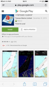
New version of Transas iSailor 2.30 for Android has been released
Android version only. New alarms; UDP connection; track recording; import export tracks.
______________________________________________________________
Garmin GPS Smart Watch Tactix Bravo
More and more popular are becoming smart watches. Apple with sky high prices Apple watches and many fake scrap value items could be found online. Even well known Garmin do not want to stay in shadow. 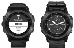
New Garmin smartwatch with GPS integration and many functions are marching on market’s highways.
The Tactix GPS Bravo features a scratch-resistant screen and bezel optimized for use with night vision goggles, as well as a suite of sensors and toolsets for military training, exploration, navigation, and “missions.”
Garmin’s new smart watch is expected to ship in late January with price tag of $699.99.
______________________________________________________________
James Bond like action Live.
 New GPS tracking device. Police car shot GPS tracker to the suspect fast car so dangerous pursuit not needed. Police squad track and other law enforcement authorities can monitor a fleeing car until it stops.
The device is is rather expensive about $5000 per unit therefore many police departments are forced just dream about it.
___________________________________________________________
Galactio-SG- very helpful Smartphone App for Asia drivers
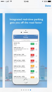 Singapore local Quantum Inventions launches really helpful GPS navigation. Galactio-SG applications are available on the Goole Play since February 2014 and November 2015 in App Store.
Galactio app integrates very useful information for drivers of real-time traffic, incidents, fuel prices and parking availability.
Also available in Malaysia, Thailand, the Philippines and Indonesia,Use Google maps Offline mode any place.
______________________________________________________________
Use Google maps Offline mode any place.
Good news for travelers and all off-road fans. Google maps became available offline.
Statistics show that about 50-60% rural areas no internet connection. There are numbers of smartphone apps offering GPS offline navigation, but Google maps are one of most favorite, and many people even do not know how to operate other. Even more those apps to an entirely function-able mode not for free.
Google maps move big step ahead as improving access for travelers even in places where no GPS signal like tunnels and dark forest or even steep building streets. It is perfect for everyone and even if you can connect the internet why spent expensive traffic MB? Just go offline and enjoy GPS navigation.
———————————————————————————————-
GPS III Will Improve Reachability.
To increase GPS accuracy and availability back in 2000 by Clinton administration was developed GPS-III program with ground control system dubbed OCX.
Up to 2017 should be launched another 32 new generation satellites, and a new system promises to be more secure against cyber attacks and available in earlier sensitive areas and spots.
The primary focus and improvements are planned for the ground support bases. It is currently a weak point for the GPS-III to be successfully implemented. The problems are both the software and the qualifications of the personnel and the rift between Raytheon, Lockheed Martin, and Air Force.
It is not yet clear when users will be able to enjoy the new GPS III satellite-navigation system advantages and benefits.
———————————————————————————————–
Hudwayglass Must Have Accessory.
An excellent, convenient and affordable car navigation accessory.
Hudway Glass. Such a type of information representation can significantly improve road safety. 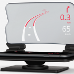 The driver will not look somewhere off the road, the information is displayed in large numbers, letters, and bright lines. Like most GPS navigation systems, Hudway apps are possible voice commands. The only thing that is not quite clear how and how strongly will hold a phone?
I like!
—————————————————————————————————–
Dig out Sextant when GPS fails.
Finally, a smart and good idea. US naval colleges restore celestial navigation training for marine cadets from 2017. I have always been indignant that young sailors know
A little about celestial navigation and many other fundamental marine navigational knowledge. Should never rely solely on electronics. I like a variety of modern technology, but I know that life inevitably comes a moment when you need to be ready for backup help.
—————————————————————————————————–
So popular WAZE is Getting even Better
WAZE is one of the very popular GPS navigation apps. New improved 4.0 version had been released Yesterday October 18, 2015. Improvements in reduced energy consumption, easy access to traffic information map, a new panel and some other. Display info now is more convenient as well as better traffic information. What I like most from first look is my GPS speed on display because car’s odometer never shows correct speed.
 —————————————————————————————-
Garmin new babyCam for Your Safety.
Garmin new babyCam device or in-vehicle video monitor will be released in January 2016. Easy 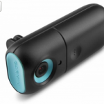 Connecting WiFi with Compatible GPS navigator. The Garmin baby Camera attaches to a front headrest and captures video of your kid. You can switch over GPS navigator by voice command or manually to check out what is going in the backseat.
———————————————————————————————————-
New Magellan eXplorist GPS navigation
Information is for off-road lovers. Recently the market has been featured a Magellan 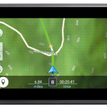 eXplorist TRX7 GPS navigator. Sturdy and great, judging by the first information, GPS navigator. Fitted with 7-inch touchscreen, internal storage memory of 16GB, preloaded US national park trails, etc. The Price is high at around $ 600, but I hope that Amazon.com could be lower. We are waiting for the first reviews. On October 13, has not appeared yet on Amazon.com.
—————————————————————————————————–
China BeiDou Navigation Satellite System
Another information. It may be news to many, but it is not news.
China has since 2000 developing their satellite navigation system. From 2012, it operates in real time and promises to complete entirely by 2020.
Fully completed the system could provide positioning data between longitude 55°E to 180°E and from latitude 55°S to 55°N with accuracy 0.2 to 10 meters and consist of 35 satellites constellation. Let’s see in five years China is the wealthy country. Competition is just better for daily users as You and me.
———————————————————————————————————-
India Satellite Navigation System
India has for some time working on your satellite navigation system Gagan (GPS Aided Geo Augmented Navigation). It is more stable than other systems because measurements never are out of set values, and especially well applicable to air transport.
Indian Regional Navigation Satellite System (IRNSS) is regional system and is available about 1,500 km beyond Indian borders. Smartphone users are using Gagan-enabled positioning system.
Indian Regional Navigation Satellite System (IRNSS) when completed will include seven satellite constellation. After that, India is more independent from GPS in a case of military conflict.
———————————————————————————————————-
