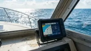
Honestly, Garmin BlueChart g2 Vision is the best marine electronic chart software so far I have come across.
From the early ages, I have obsessed with distant countries, mysterious islands, and coasts. Marine Nautical charts are an essential part to reach them.
I was born next to the sea, and all my life lived and worked at jobs related to the sea. One may say that I am familiar with marine charts at the same time when I started to read books.
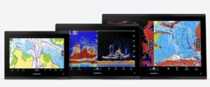
For me reading nautical paper charts is the as easy task as reading a book. This factor is the main reason why I count Garmin Bluechart g2 nautical charting system the best could be found on the market so far. Charts and navigating by the wide range of Garmin marine navigation devices screens look like traditional paper charts.
I assume that a lot of GPS for boats users never even seen paper navigation charts. It is entirely understandable in today’s era of electronic achievements.
So my BlueChart rating could be assessed as relatively subjective. Many may argue that there are other and better solutions for the marine cartography available. I would say that no one is perfect. Be it Fugavi, Navionics, Jepsen C-Maps, and others have its pros and cons.
For example, I was and am happy with the Navionics app for iPhone.
I even used it as a backup solution in real high seas sailing after my standalone Raymarine C-Map and Windows Acer laptop loaded with MaxSea were dead due to some reasons.
I still have Navionics app in my iPhone 6S Plus and used to use it when I am going for ice fishing on Peipsi Lake Estonia. Perform just great and finding fishing spots with ease. To be honest and the price of real marine charts on my smartphone screen is so affordable that I sometimes even wondering why.
I have written my thoughts about main marine navigation software so you can read it just somehow missed Garmin Bluechart g2 offer.
So, what is Garmin BlueChart g2 Vision?
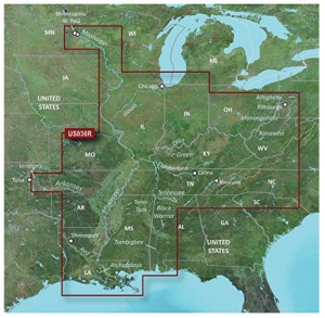
It is detailed nautical charts, in object-oriented vector format and provides premium mapping and graphics capabilities
It, as I said before, shows almost the same picture as on paper charts just you do not need to carry thick paper chart rolls and draw your sea passage by pencil and looking for a safe place to store them. By spending some time to read a device manual you could enjoy endless opportunities for pleasure sailing, fishing, scuba diving or even long high seas voyage.
I would not like to explain all features of BlueChart software just wanna add that it has almost every need for boaters like you and me. Even more, as the ex-navigation officer on commercial ships, I assume that it could be used for commercial navigation as well. The only thing I am not sure that maps cover entire oceans, need to check.
My conclusion after doing searches on my.garmin web page. I could easily navigate ships I have sailed on my sea job career using those nautical soft. The only problem is, as far as know, there are designated IMO (International Maritime Organization) approved Electronic Nautical Chart (ENC) software to be used on SOLAS vessels. I guess that BlueCharts is not on the list.
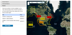
When it comes to boaters and marine recreational adventurer on sailing yachts the Garmin BlueChart g2 Vision coverage is close to global. You have to check before long range voyage planning.
A little deviation from the theme.
I am a fan of long-range ocean regattas, and Volvo Ocean Race is my favorite.
As far as I have some sailing experience plus professional marine navigation skills, it was very thrilling and addicted sailing all 2014/
2015 Volvo Ocean Race nine month route round the globe virtually together with all seven Volvo Ocean 65 one-design racing yachts.It is a great place to be when it comes to participating in virtual sailing regattas. Follow and even virtually compete not only with other virtual racers but even with real guys and girls on board of the state of art racing sailboats having the same routes and wind conditions with prediction ability.
What navigation software did they use?
It is interesting to me because of another not very pleasant event.
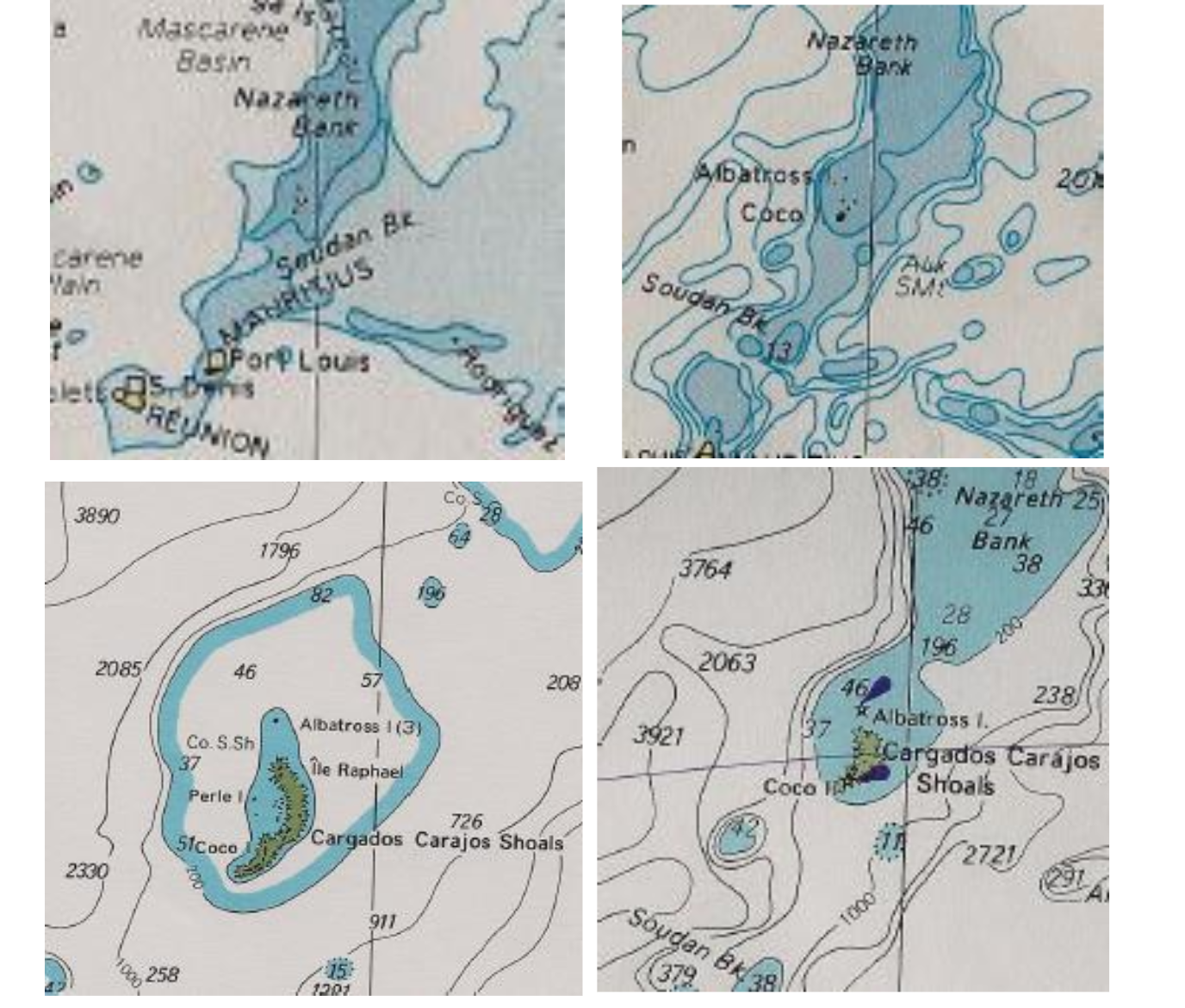
It was stranding of Team Vestas WindNovember 29,2014, on the Cargados Carajos Shoals 240 nm northeast of Mauritius while competing in the 2014/2015 Volvo Ocean Race round the world in mid of Indian Ocean. Luckily without human casualties.
The detailed Vestas Wind Report is available here.
So, what navigation software did they use?
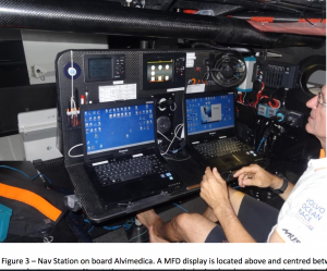
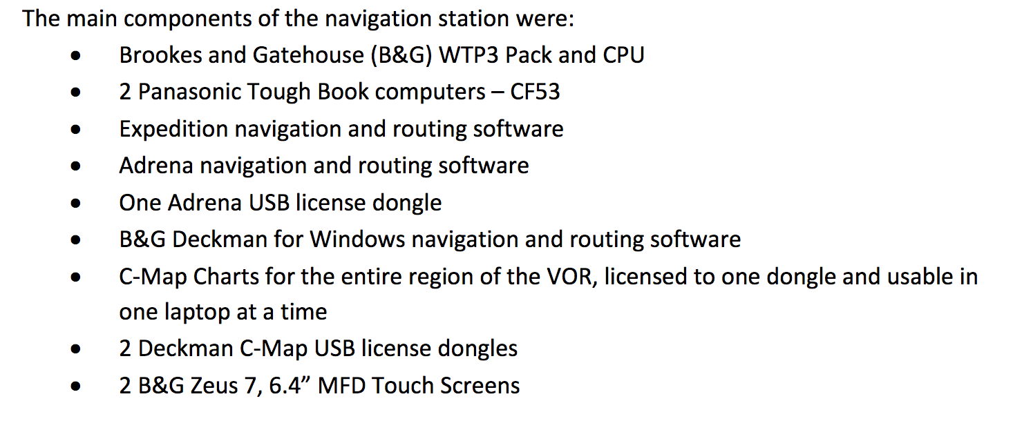
When stated in the review and you can see in the screenshot it is Jepsen Sea-Map Charts for the entire region of the VOR (Volvo Ocean Race) and Adrena navigation and routing software I never heard before.
Here is my thoughts on this grounding.
It was a set of circumstances in which a key component was the human factor. One of that was the inappropriate use of nautical charts software. What is hard to find at the review but have been heard that only one more „zoom in“ on map screen has discovered a fateful reef. Regardless of weak hydrographic survey data, the paper navigation charts indicate Cargados Carajos Shoal clearly.
It sounds a bit ridiculous reading „traditional navigation method“?Using of a sextant for celestial navigation on high tech 20 knots flying and millions of dollars worth sailboat?
Such a warning on a Data License Agreement leads to thinking of cowardice and responsibility removal. It even seems as previously known faulty or useless product creation.
Adding to Vestas Wind stranding, I had my own real story on Muhu Vain Regatta back in Summer 2008. It is an Estonian organized yearly sailing regatta and race usually, include rocky narrows between West Estonian archipelago islands.
Our skipper and I, as a navigator, were warned about stones which could not be on charted positions due to winter ice fields movement and was advised to keep clear of those dangers. Following the advice, I made the voyage plan avoiding mentioned rocks although it was a longer path.
The main fleet of local Estonian yachts sailed through dangerous but shorter track. They considered themselves as local who knows every stone, even after winter.
After the finish, where we were in the second place position, but three Estonian yachts did not show up because hitting rocks causing damages and losing an ability to continue the race.
Why do I write about it?
I just wanna say that as I was taught, consider to be closer to danger and keep clear of it as far as possible for safe navigation.
Actually, these all my mentioned navigation software makers are private companies, and there are no commonly agreed standards for the transfer, prioritization, and display of data between the various commercial products.
Why create and sell a product to what cannot be relied upon?
I have deviated from my title theme, but all that I said about Team Vestas Wind stranding are somehow related to it.
I am not sure how exactly the grounding spot looks on compatible Garmin GPS device screen but as the picture on Garmin BlueChart g2 Vision map screen is the same as nautical paper charts have then the possibility to spot out the danger could be much higher.
When it comes to prices of the Garmin Bluechart G2, it can be said that they are about the same as for the other on the market.



Andrel,
This is an interesting topic for me but on a different plane.
My blog for first time campers suggests that GPS systems are good for guidance as long as there is direct line of site with the satellites.
Too often, when you need them the most is when they won’t work for that reason. Mountains and trees can block the line of site view to your unit and may not serve you well. For that reason I go back to the old hand held compass .
I am a firm believer that as things become more high tech, not to forget the old school analogue stuff that has worked for centuries.
Being a retired employee of Space Systems Loral in Palo Alto Ca. I know things are improving by using multiple low orbit satellites. Thus giving more satellites on the job for your use.
I hope they can create a system that works in a covered situation but I’ll still keep my compass as well.
Thanks for a well written post. Good information.
Hi, and thank you for honest and wise words!
You are right that GPS or other sat nav systems signals like Russian GLONASS and European Galileo can not be achieved due to various reasons. Even more sat nav signals could be jammed or switched off for security reasons or just to interrupt signals like North Korea recently did in the close border are with South Korea.
But you will agree that modern technology is no longer imaginable without the presence of GPS.