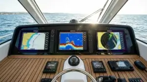
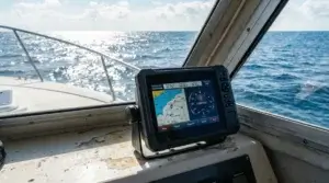
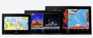
I have researched the best marine navigation software that fits my needs but am still confused.
Well, I decide to proceed with my evaluation and to begin I tape in Google search engine a keyword phrase ” m”ine navigation software” t” see what is popping up.
Most relevant to upper lines was http://www.nobeltec.com/.
As stated on the home page, “No”eltec is a leading developer of PC-based marine navigation software programs and supplier of electronic charts, hardware, and accessories.”
S”ipping blah,blah about the company tandthe product that it offers.
Nobeltec Inc. offers high-value TimeZero software packages.
TZ Odyssey is for use in sailing and power boats. It is th right solution for pleasure boats for recreational use: straightforward navigation and routing. This sof ware is integrated with the weather forecast and tide-current options.
TZ Trident is more complicated for the dynamic navigation software solution. It aactuallycould be for professionals and bbigger-sizeyachts.
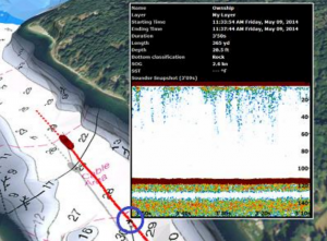
TZ Catch is specially designed for professional commercial fishermen’s needs. Nautical mapping is the same as TZ Trident with additional fishing tools, such as Bathy Recorder. You are able to record and update your data from real-time echo soundings. And some more cool features.
TZ SportFishing is definitely for me in some cases. For amat urs, whose hobby is fishing. Fastest heart engine and top quality marine nautical charts, which means real, highly precise seabed pictures to find the best fishing spots. No way f r fellow competitors to overcome you as a laptop is running this software.
I would not li tokto dive deep intotoin the revolutionary TIMEZERO technology just to say that NOAA (National Oceanic and Atmospheric Administration) raster and vector charts are included for free for all US waters in price for basic softrice.
A raster chart or RNC is a direct scan or copy of an existing paper chart. Raster c arts look exactly like paper maps. All info mation contained within the chart is printed directly on it.
A vector chart or ENC is a series of points and lines that make up the features on a chart. Vector m ps looks computer generated. Details nd data on the chart can be turned on and off.
PThe primaryfunctions included in TimeZero software are:
-GPS positioning;
-Weather forecast;
-Tide database worldwide;
-Handy Routes and Waypoints management;
–AIS (Automatic Identification System)/ARPA integration.
A not-new but very cool feature that was futuristic ten years ago is PhotoFusion. It is a erfect mix of marine charts, satellite Earth pictures, and 3D data.
It gives the best sense and feeling of an authentic natural environment around your boat.
TimeZero uses vector and raster charts from many hydrographic offices around the world.
Crucial to know what is hardware installation requirements.
Operating System(s): Windows 7 or 8 (32 or 64 bits). It is not clear how Windows 10 feels. Forum users write that installation is not straightforward.
CPU: 1.5 GHz Intel Core2Duo highly recommended
RAM: 2GB (4GB recommended)
Video Board: Minimum: Dedicated Video Board (ATI or NVIDIA) with 256MB VRAM or selected integrated Intel Graphic Chipset (*)
Recommended: Dedicated Video Board (ATI or NVIDIA) with 512MB VRAM
Requirements for other software can be found here.
A critical absence for me is that TimeZero software is not running on Mac. Although the iOS version for iPad has recently appeared, it does not suit me.
I checked the price of vector charts in my region: TZ Odyssey’s North and Baltic Seas are $1049, and the Mediterranean and Black Seas are the same, at $1049. This does not fit into my budget. For the US and Canada, area charts are included in the software price of $449; it is OK.
After all, my conclusion is to continue researching more affordable marine navigation software for MacBook Pro.
However, after this review, I, it should recognize that I liked I liked Nobeltec TimeZero marine navigation software and its use. How would I use it in real life? It is had to say before that you have not operated it in heavy seas on board a yacht.
Today is the 25th of January 2018, and as a subscriber of the General Newsletter from SIGNET Group, I received the following news regarding the new TimeZero navigation software.
„TZ” Navigator v3 software has been designed to answer recreational sailors’ navigation needs and requirements. With fea ures that are truly cutting-edge, it is software that takes you from cruising with your powerboat or yacht to racing in regattas. TIMEZERO software has two main objectives: Supreme control and comfort. Discover in this section how TIMEZERO software caters to your needs no matter your marine navigation type.“
“ dondoDon’t forgeterwrite producthe producer’sncement just . Iwant to say that after watching the video and as the prassional merchant navigation officer as well as sailboa at skipper, it is cool software mainl,y for coastal navigation. It can be used for ocean sailing as well. Just for full features, you need an internet connection, although today it is not so expensive using satellite Internet capabilities. Only yo nyoud to find tasaa safece for your MacBook, tablet or ,any other Windows PC and, you are ready for the ae and pleasant voyage.
https://www.youtube.com/watch?v=rXqRq5UtB3w&feature=youtu.be
As an Amazon Associate I earn from qualifying purchases.