Marine Traffic AIS Vessel Tracking and my Job.
Marine traffic control in sea ports and high-density ships movement areas is the main task for Vessel Traffic Systems (VTS).
What actually those guys, sometimes even girls, are doing in their hi-tech VTS Towers?
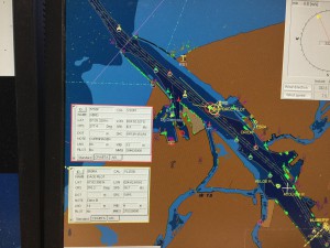
As I mentioned in About Me page, my job is closely related to ships, harbor and other marine related spheres. I am one of those guys who watching, informing, advising, regulating and in other ways help shipmasters when they arriving or departing from my VTS responsibility zone. For me, it is Freeport of Riga in Latvia which is one of busiest marine crossroad from Europe to Russia and East.
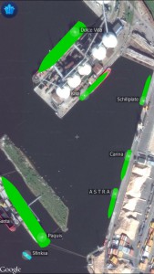
I would not like to talk much about my job tasks, that is another story. Just to know, as my site is more or less about GPS navigation and other Global Positioning System related themes, I would say that almost all equipment in my working place somehow are related with GPS. Even my iPhone 6s plus in my pocket loaded with Marine Traffic Live map is using GPS receiver.
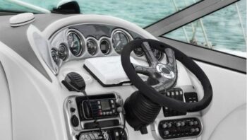
There is no secret that ships finding their highways or streets on seas and oceans mainly with a help of satellite navigation systems. Ship’s position obtaining by celestial objects counting currents and winds is fading away and young navigators sadly almost do not know how to do it.
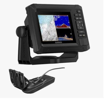
One of the most popular until now is GPS or Global Positioning System. There are some others as Russian GLONASS, EU Galileo, India has his local IRNSS stands for Indian Regional Navigation Satellite System. Even China is developing his own SatNav constellation named BeiDou. Truly it is great that GPS have an alternative. Habitually we call any satnav device as GPS but it is not correct. Nowadays many manufacturers combine in their devices such receivers which are able to communicate with GLONASS and even Galileo. So to name all of the satellite navigation devices GPS not fair in relation to other participants.
Electronic charts providing detailed and constantly updated information about navigational aids, safe under keel clearance and even other traffic sources (ship’s) names, IMO numbers, speed and course.
Information about vessel’s details recently become available by implementing marine traffic AIS (automatic identification system).
In short, AIS is a vessel tracking system which is capable of communicating and exchanging navigation information automatically between such a device equipped vessels and coastal authorities as VTS, Coast Guard, MRCC etc.
AIS is compulsory for almost all types and sizes of vessels and it significantly increase the level of safety on water transport. Not so long time ago to identify visible or by radar detected target you had to communicate by VHF radio. And even after contact you had no hundred percent clear that it is right responder. Misunderstandings used to happen which sometimes cause near misses or even collisions.
In my VTS operation area almost every winter approaches to port usually are covered by ice and not always icebreakers assistance is available immediately. There were situations that up yo 30-40 ships were stuck in ice. Who is who, without AIS are almost unable to detect. Everyone is calling for help, but which one needs it firstly is very hard to point out. Today by help of marine traffic AIS receivers and transmitters it is possible to resolve this issue even sitting in your comfortable car checking situation by smartphone marine traffic live map apps.
I forgot mention radars in my job and on board of every vessel. AIS is the very helpful invention as well as GPS chartplotters and electronic maps. But a radar is still the main eyes, naturally next to your own, and navigation safety equipment on ship’s bridge as well as in my VTS tower.
As I said, not every ship is obliged to carry AIS, so if you blindly trust just on AIS that sooner or later sad result is guaranteed. Marine radar sees everything and in every weather condition night and day. You just have to know how to properly operate this navigation tool and adjust it up to weather conditions. Latest marine radars are so smart with integrated charts and AIS and you could feel very comfortable to sail even in dense fog or heavy snowfall.
Using such smart combination of Onboard equipment and your own eyes, ears and brains, then your and other lives are in safety and our environment remains clean and oceans unpolluted.
In conclusion I’d like to say that even the most advanced navigation tool will never outweigh human being with his unique tool which is called BRAINS. So let’s be professionals and count all our tools and devices as our best friends and helpers in such a beautiful journey named – Life.
___________________________________________________________
I would love to hear and read your comments, questions and feedback below (so don’t forget to leave it!).


Post Comment